Archives

Trail 0 4 0


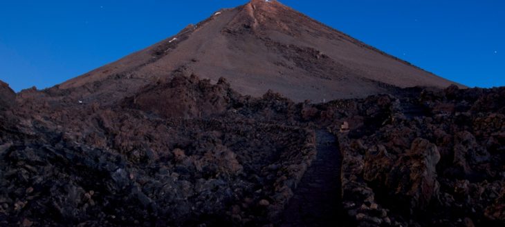
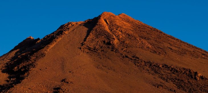
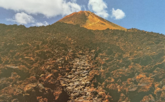
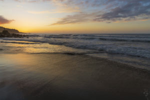
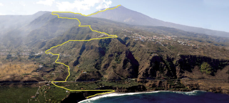
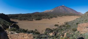
Tenerife‘s route 040 is an adventurous trail that reaches the summit of mount Teide, starting from the shore of Socorro beach in the municipality of Los Realejos and returning on the same path until one has once again set foot on the volcanic sand of the beach. It is, without a doubt, the toughest of Teide’s challenges, the third highest volcano on the planet as measured from its base.

The powers of evil, a kind of netherworld, which they greatly feared, lay hidden in the interior of Echeyde, which is what the aboriginal Guanches called the volcano, whose image was always surrounded with mystery. In addition to the achievement of this great feat, which with nearly 7,600 meters of accumulated height difference and 54 kilometers of mountainous route, it is the route with the highest orographic height difference in Spain, thus turning the island of Tenerife into an attractive sporting and a destination with cult status.

Reaching the summit of the Atlantic giant is a huge challenge. But it only finishes once you have returned to sea level again. As those who love mountaineering say: “you’ve only finished the climb once you’ve come back down again

For experienced runners and properly trained athletes, the route is considered a challenge to be completed in a single day. Many athletes and skyrunners of international renoun have attained it, each season achieving a previously unimaginable new record. For those less prepared in this type of tests, it is recommended to enjoy the route in several stages, completing the phases in two or three days, thus achieving the final goal more comfortably and with equal satisfaction.

In addition, the climatic conditions of the island allow this trail to be done during much of the year, except in winter when Teide is often covered with snow.

A unique experience in an amazing place. Route 040 leaves no-one unmoved. Accept the challenge and enjoy it.

Warning

  • During the periods from May 5th to June 13th, and from October 2nd to November 30th access to the route 040 from Piedra de Los Pastores to the Teide summit is closed from Monadys to Fridays.

Route Map

Apuntes de interés

A BIT OF HISTORY


The municipality of Los Realejos, in the north of the island of Tenerife, has a quite remarkable orography. On its territory we find the Tigaiga mountains, a millions of years old massif that closes the Orotava Valley on the west. The trail which boasts the highest cumulative altitude on the island, runs along these steep slopes. A circular route that starts from level 0 on the Socorro beach to climb the Pico del Teide at 3,715 meters of altitude, and descend by the same path, back to the volcanic sand of the coast.

The trajectory of Route 040 is given by various old roads that connected farmsteads and hamlets of the municipality of Los Realejos, as well as others trails that ascended to the area of Las Cañadas and linked with those of the south of the Island. These roads were used for all types of transit: goods, animals and people that went up or down from the highest areas to the coast or vice versa.

Added to this is the interest shown by foreign visitors, since at least the 18th century, to climb Mount Teide and reach its summit. These characters, mostly scientists and naturalists, organized excursions that started from Puerto de la Cruz, passing through Los Realejos, and continue along these old trails that reached Las Cañadas, and from there start the ascent to the summit. There are many written testimonies about these outings that lasted several days, with different stages, many of them full of details and descriptions of places, notes about flora and fauna, as well as the people that accompanied them. It is through these notes that we know how the trail matches the current route 040.

Likewise, during the 20th century, the trail has been improved by different measures carried out by government agencies, such as the former Institute of Nature Conservation ICONA and later the Cabildo de Tenerife and the Canary Islands Government. Most important among them is the building of tracks to facilitate communication in the event of forest fires.

It wasn’t until 2018, though, and given the popularity acquired by the route, when different
institutions projected its improvement and homologation as a trail.

NOTES ABOUT FLORA AND FAUNA

The trajectory of Route 040 takes us into protected natural reserves such as the Rambla de Castro, Tigaiga, Campeches and Ruiz, the Corona Forestal and the Teide National Park, where we can get to know first hand the wealth of the ecosystems and altitudinal zones of the north side of the island of Tenerife..

The rich biodiversity is evident in the multitude of plant and animal species that live in these places, especially on the slopes of Tigaiga, which reach from the cliffs on the coast to El Cabezón in the Teide National Park, where we find authentic relics of our natural heritage.


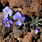
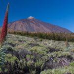
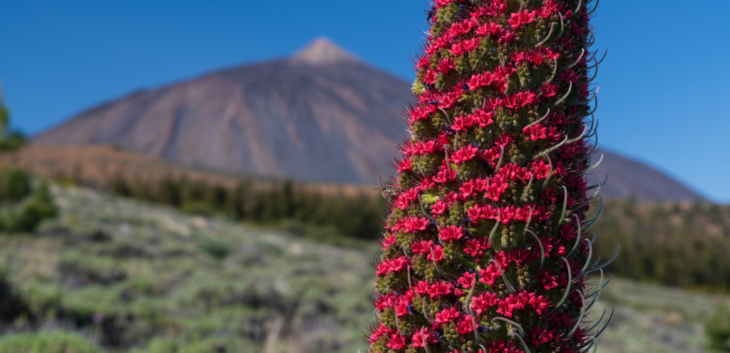
The summit or high mountain area is the habitat of the Pterocephalus lasiospermus (rosalito de la cumbre), with its striking flowers, the Tenerife blugloss and the retama brooms, as well as an endemic fauna, especially the invertebrate, which goes mostly unnoticed in the lava flows of Las Cañadas del Teide. The National Park, the most visited in Europe, has a rich and varied biodiversity, much of it located between solidified rivers of lava.


The vast expanse of the Corona Forestal is a nesting place for the blue chaffinch, the great spotted woodpecker and the black-headed warbler, which share this space within the mountain shrublands and the laurel forest. In the so-called monteverde, the humidity of the trade winds has maintained this millenary stronghold of species, both plant and animal, that coexist among pines, wild olive trees, persea indica, small-leaved hollies, picconia excelsa, stinkwood and Canary laurels, excellent sources of food for the white tailed laurel pigeons.


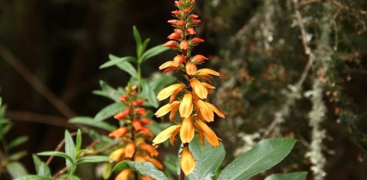
In the area of the midlands and where we find the main human settlements, the old thermophilic forests remain as vestiges of larger areas that have now disappeared. In them, junipers, dragon trees and palm trees can be found in the company of clary sage, morning-glory-trees, gold rod trees, tree limonium, dogfennel, Canary Island sorrel and the colourful Canary foxgloves. The fauna is numerous, among which the Tenerife lizard, the partridge, the kestrel and the common canary stand out. On the coast, the balsam spurge and the remains of Canary Islands spurge predominate, along with nesting areas for birds, especially shearwaters.


This natural wealth coexists with a particular cultural heritage that the municipality conserves thanks to a fruitful history that goes back several centuries. Los Realejos boasts with being the most festive town in Spain, with more than eighty festivities throughout the year. In its hamlets and districts, customs linked to the agricultural cycle, gastronomy, oral tradition and folklore are maintained, passed on from generation to generation by a population that has continued to look to its ancestral roots.


To visit the municipality is to enter its midlands; landscapes marked by narrow terraces, which in many cases contrast with extensions on which cereals and “bonita” potatoes are grown. Both products have a deep roots in the high areas of the municipality.


Los Realejos offers many possibilities to learn about its history in its cultural heritage, practice active sports such as paragliding, surfing and bodyboarding, hiking, trail running, or enjoy its festivals and gastronomy.


Route 040 is an example of this, since it allows you to get to know part of that legacy, both cultural and natural, traveling its more than 56 kilometers of trail, starting from the waters of the Socorro beach, ascending Mount Teide to crown it, and going back down again to return to the black sand of our coast.

Route directions

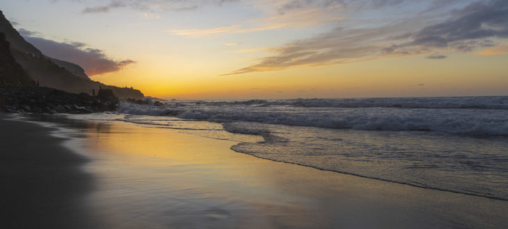
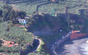
  • We start off our hike at sea level on the black sands of Socorro beach. Here we take the road that leads us u to the TF-5 main road and we ascend up to the first crossroads.
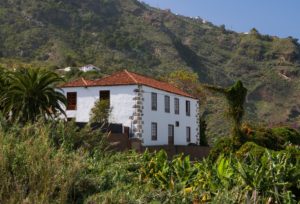
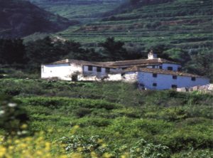
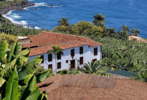
  • On the way up, we will leave to our right the Hacienda de las Cuatro Ventanas manor and the crossroads between bananas that allows us to reach the Guindaste natural pools. We pass under the tunnel and cross the road to take the path next to the signpost.
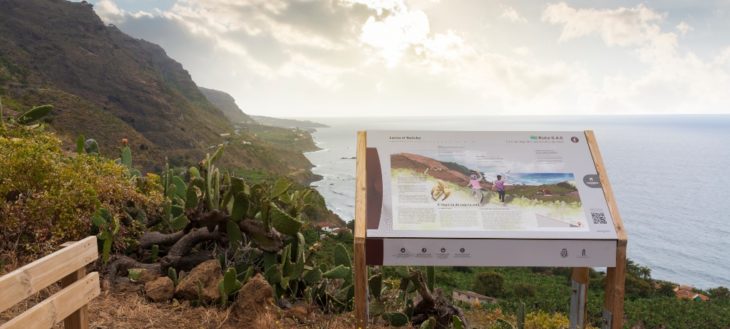
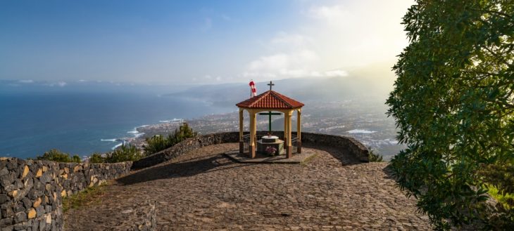
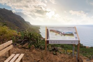
  • We climb up to the upper part of the ridge known as “Lomo del Bloliche” where there is a panel with a representation of the views of the Rambla. We walk down to the “La Cueva” road and then continue ascending.
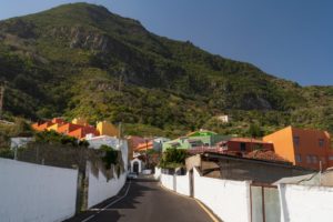
  • We take the “La Cueva” road and continue ascending a stretch of land until we reach the hamlet. From here we continue on the asphalted road until the intersection.
  • At the intersection we turn left, walking a few hundred metres until we reach the intersection with “Camino Las Piedras” to the right.
  • We walk up “Camino Las Piedras” which is asphalted and reach “Calle Tigaiga” at the upper end. There is a well here, where we can refill our water bottles. We now have to turn left.
  • We each the sawmill at the intersection with the chapel of the “Cross of the Sawmill”. Here we turn right and begin the ascent on the old road “Camino de Las Vueltas”.
  • The first section of “Camino de las Vuletas” is partly asphalted, partly cemented that ends in a dirt road. Here we turn right and follow the original route. We walk up a winding, stone paved path until we reach the TF-342 main road.
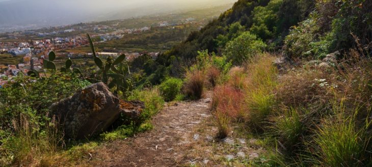
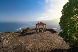
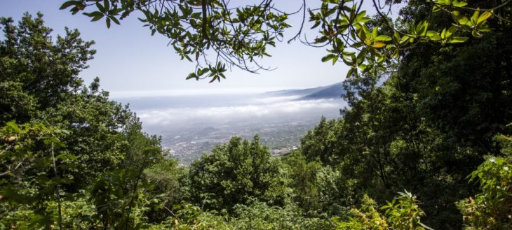
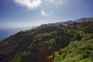
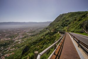
  • On the Icod el Alto general road weturn right onto the pedestrian zone that along the edge of the road in direction of the El Lance lookout where we have impressive views of the Orotava Valley and part of the island’s north coast.
  • Once past the El Lance viewpoint, we will continue along the pedestrian walkway until we see a pedestrian crossing on the left which we must take to go onto “Calle El Lance” street.
  • This street has some particularly steep sections so we must be very careful, especially if there is traffic.
  • After passing through the inhabited area we reach an agricultural area where we will find the path that will take us to the La Corona lookout.
  • From the La Corona outlook we can contemplate some of the most beautiful landscapes of the island’s north. We take the trail next to the geodesic mark and next to the parking area until we reach the “Asomadero” without turning from the path. The path goes on being steep and it has slippery stretches.
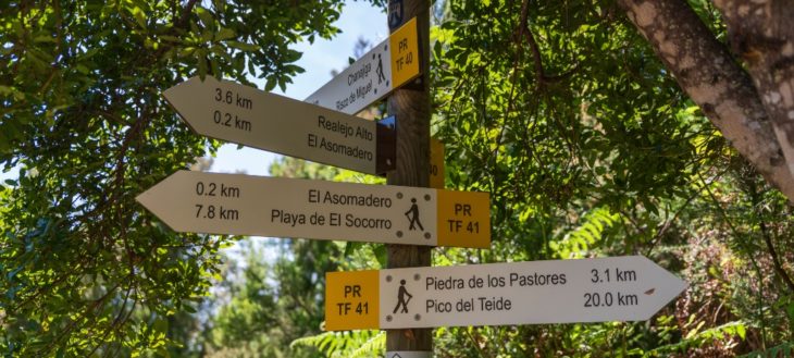
  • From the “Asomedero” lookout, situated at 1,100 metres above sea level, we can enjoy spectacular views of mount Teide and the entire Orotava Valley. Several antennae are situated here and the PRTF 40 Trail passes through here, too. We continue our trail in ascent.
  • A few netres further on we encouter a crossing of several trails: Chanajiga / Pino Llorón / Corral Quemado. We continue upwards without leaving the main trail.
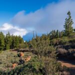
  • We cross an area of shrubland and pine forest with several intersections that we must not use. We reach an area known as “Piedra de los Pastores” (Shepherds’ Stone) and continue along the main trail.
  • We pass the “Piedra de la Gallega”, the “Colmenar de la Chapa” and enter the National Park. Crossing the barrier we continue along the main path, turning a curve to the left and taking the path on the right until we reach the lookout of “El Cabezón” an 2,166 metres above sea level.
  • We mustn’t leave the main trail until we reach the foot of the “La Fortaleza” cliffs where we find the Chapel of Fregel or of the “Degollada” (the beheaded). Once we arrive here we continue on a short descent onto the plain.
  • One on the plain that bears several names: Los Guancheros, de la Degollada, de las Brujas, we turn right onto th emain trail that leads us past a fenced plot of land, to National Park trail number 22 on the left. We cross the whole plain along this trail.
  • At the end of trail 22 we connect with trail number 6 in the area of “Montaña de Los Conejos” (Rabbits’ Mountain). This trail also belong to the network of trail of the National Park. We reach the intersection with the Montaña Blanca trail and further on we take trail number 7 that will take us to the summit.
  • We continue along trail number 7, passing Montaña Blanca, an area of pumice, that leads through areas which are quite steep, some as much as 60%.
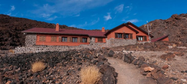
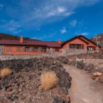
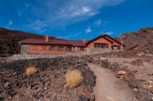
  • Halfway from Montaña Blanca we arrive at the Altavista Refuge, where we can rest.  Inside we can drink water or refill the bottles, to continue on the road to Rambleta.
  • The trail ends at this point, La Rambleta, and on the left the Telesforo Bravo trail begins that will lead us to the peak. You can only walk through it with a special permit (see other information of interest). It is a high altitude, very steel section.
  • The summit is the mid point of Route 040. On a clear day you can see all seven islands and large part of the island of Tenerife. Once arrived at the summit, the return journey is along the same route, only in the opposite direction, which means we have to pass the itinerary points in reverse order.

IMAGE GALLERY

View all the pictures

Route video


Practical information

Route 0 4 0


Tenerife‘s route 040 is an adventurous trail that reaches the summit of mount Teide, starting from the shore of Socorro beach in the municipality of Los Realejos and returning on the same path until one has once again set foot on the volcanic sand of the beach. It is, without a doubt, the toughest of Teide’s challenges, the third highest volcano on the planet as measured from its base.

Reaching the summit of the Atlantic giant is a huge challenge. But it only finishes once you have returned to sea level again. As those who love mountaineering say: “you’ve only finished the climb once you’ve come back down again.”

The powers of evil, a kind of netherworld, which they greatly feared, lay hidden in the interior of Echeyde, which is what the aboriginal Guanches called the volcano, whose image was always surrounded with mystery. In addition to the achievement of this great feat, which with nearly 7,600 meters of accumulated height difference and 54 kilometers of mountainous route, it is the route with the highest orographic height difference in Spain, thus turning the island of Tenerife into an attractive sporting and a destination with cult status.

For experienced runners and properly trained athletes, the route is considered a challenge to be completed in a single day. Many athletes and skyrunners of international renoun have attained it, each season achieving a previously unimaginable new record. For those less prepared in this type of tests, it is recommended to enjoy the route in several stages, completing the phases in two or three days, thus achieving the final goal more comfortably and with equal satisfaction.

In addition, the climatic conditions of the island allow this trail to be done during much of the year, except in winter when Teide is often covered with snow.

A unique experience in an amazing place. Route 040 leaves no-one unmoved. Accept the challenge and enjoy it.

Warning

  • During the periods from May 5th to June 13th, and from October 2nd to November 30th access to the route 040 from Piedra de Los Pastores to the Teide summit is closed from Monadys to Fridays.

Route Map

Apuntes de interés

A BIT OF HISTORY


The municipality of Los Realejos, in the north of the island of Tenerife, has a quite remarkable orography. On its territory we find the Tigaiga mountains, a millions of years old massif that closes the Orotava Valley on the west. The trail which boasts the highest cumulative altitude on the island, runs along these steep slopes. A circular route that starts from level 0 on the Socorro beach to climb the Pico del Teide at 3,715 meters of altitude, and descend by the same path, back to the volcanic sand of the coast.

The trajectory of Route 040 is given by various old roads that connected farmsteads and hamlets of the municipality of Los Realejos, as well as others trails that ascended to the area of Las Cañadas and linked with those of the south of the Island. These roads were used for all types of transit: goods, animals and people that went up or down from the highest areas to the coast or vice versa.

Added to this is the interest shown by foreign visitors, since at least the 18th century, to climb Mount Teide and reach its summit. These characters, mostly scientists and naturalists, organized excursions that started from Puerto de la Cruz, passing through Los Realejos, and continue along these old trails that reached Las Cañadas, and from there start the ascent to the summit. There are many written testimonies about these outings that lasted several days, with different stages, many of them full of details and descriptions of places, notes about flora and fauna, as well as the people that accompanied them. It is through these notes that we know how the trail matches the current route 040.

Likewise, during the 20th century, the trail has been improved by different measures carried out by government agencies, such as the former Institute of Nature Conservation ICONA and later the Cabildo de Tenerife and the Canary Islands Government. Most important among them is the building of tracks to facilitate communication in the event of forest fires.

It wasn’t until 2018, though, and given the popularity acquired by the route, when different
institutions projected its improvement and homologation as a trail.

NOTES ABOUT FLORA AND FAUNA


The trajectory of Route 040 takes us into protected natural reserves such as the Rambla de Castro, Tigaiga, Campeches and Ruiz, the Corona Forestal and the Teide National Park, where we can get to know first hand the wealth of the ecosystems and altitudinal zones of the north side of the island of Tenerife..

The rich biodiversity is evident in the multitude of plant and animal species that live in these places, especially on the slopes of Tigaiga, which reach from the cliffs on the coast to El Cabezón in the Teide National Park, where we find authentic relics of our natural heritage.


The summit or high mountain area is the habitat of the Pterocephalus lasiospermus (rosalito de la cumbre), with its striking flowers, the Tenerife blugloss and the retama brooms, as well as an endemic fauna, especially the invertebrate, which goes mostly unnoticed in the lava flows of Las Cañadas del Teide. The National Park, the most visited in Europe, has a rich and varied biodiversity, much of it located between solidified rivers of lava.


The vast expanse of the Corona Forestal is a nesting place for the blue chaffinch, the great spotted woodpecker and the black-headed warbler, which share this space within the mountain shrublands and the laurel forest. In the so-called monteverde, the humidity of the trade winds has maintained this millenary stronghold of species, both plant and animal, that coexist among pines, wild olive trees, persea indica, small-leaved hollies, picconia excelsa, stinkwood and Canary laurels, excellent sources of food for the white tailed laurel pigeons.


In the area of the midlands and where we find the main human settlements, the old thermophilic forests remain as vestiges of larger areas that have now disappeared. In them, junipers, dragon trees and palm trees can be found in the company of clary sage, morning-glory-trees, gold rod trees, tree limonium, dogfennel, Canary Island sorrel and the colourful Canary foxgloves. The fauna is numerous, among which the Tenerife lizard, the partridge, the kestrel and the common canary stand out. On the coast, the balsam spurge and the remains of Canary Islands spurge predominate, along with nesting areas for birds, especially shearwaters.


This natural wealth coexists with a particular cultural heritage that the municipality conserves thanks to a fruitful history that goes back several centuries. Los Realejos boasts with being the most festive town in Spain, with more than eighty festivities throughout the year. In its hamlets and districts, customs linked to the agricultural cycle, gastronomy, oral tradition and folklore are maintained, passed on from generation to generation by a population that has continued to look to its ancestral roots.


To visit the municipality is to enter its midlands; landscapes marked by narrow terraces, which in many cases contrast with extensions on which cereals and “bonita” potatoes are grown. Both products have a deep roots in the high areas of the municipality.


Los Realejos offers many possibilities to learn about its history in its cultural heritage, practice active sports such as paragliding, surfing and bodyboarding, hiking, trail running, or enjoy its festivals and gastronomy.


Route 040 is an example of this, since it allows you to get to know part of that legacy, both cultural and natural, traveling its more than 56 kilometers of trail, starting from the waters of the Socorro beach, ascending Mount Teide to crown it, and going back down again to return to the black sand of our coast.

Route directions

  • We start off our hike at sea level on the black sands of Socorro beach. Here we take the road that leads us u to the TF-5 main road and we ascend up to the first crossroads.
  • On the way up, we will leave to our right the Hacienda de las Cuatro Ventanas manor and the crossroads between bananas that allows us to reach the Guindaste natural pools. We pass under the tunnel and cross the road to take the path next to the signpost.
  • We climb up to the upper part of the ridge known as “Lomo del Bloliche” where there is a panel with a representation of the views of the Rambla. We walk down to the “La Cueva” road and then continue ascending.
  • We take the “La Cueva” road and continue ascending a stretch of land until we reach the hamlet. From here we continue on the asphalted road until the intersection.
  • At the intersection we turn left, walking a few hundred metres until we reach the intersection with “Camino Las Piedras” to the right.
  • We walk up “Camino Las Piedras” which is asphalted and reach “Calle Tigaiga” at the upper end. There is a well here, where we can refill our water bottles. We now have to turn left.
  • We each the sawmill at the intersection with the chapel of the “Cross of the Sawmill”. Here we turn right and begin the ascent on the old road “Camino de Las Vueltas”.
  • The first section of “Camino de las Vuletas” is partly asphalted, partly cemented that ends in a dirt road. Here we turn right and follow the original route. We walk up a winding, stone paved path until we reach the TF-342 main road.
  • On the Icod el Alto general road weturn right onto the pedestrian zone that along the edge of the road in direction of the El Lance lookout where we have impressive views of the Orotava Valley and part of the island’s north coast.
  • Once past the El Lance viewpoint, we will continue along the pedestrian walkway until we see a pedestrian crossing on the left which we must take to go onto “Calle El Lance” street.
  • This street has some particularly steep sections so we must be very careful, especially if there is traffic.
  • After passing through the inhabited area we reach an agricultural area where we will find the path that will take us to the La Corona lookout.
  • From the La Corona outlook we can contemplate some of the most beautiful landscapes of the island’s north. We take the trail next to the geodesic mark and next to the parking area until we reach the “Asomadero” without turning from the path. The path goes on being steep and it has slippery stretches.
  • From the “Asomedero” lookout, situated at 1,100 metres above sea level, we can enjoy spectacular views of mount Teide and the entire Orotava Valley. Several antennae are situated here and the PRTF 40 Trail passes through here, too. We continue our trail in ascent.
  • A few netres further on we encouter a crossing of several trails: Chanajiga / Pino Llorón / Corral Quemado. We continue upwards without leaving the main trail.
  • We cross an area of shrubland and pine forest with several intersections that we must not use. We reach an area known as “Piedra de los Pastores” (Shepherds’ Stone) and continue along the main trail.
  • We pass the “Piedra de la Gallega”, the “Colmenar de la Chapa” and enter the National Park. Crossing the barrier we continue along the main path, turning a curve to the left and taking the path on the right until we reach the lookout of “El Cabezón” an 2,166 metres above sea level.
  • We mustn’t leave the main trail until we reach the foot of the “La Fortaleza” cliffs where we find the Chapel of Fregel or of the “Degollada” (the beheaded). Once we arrive here we continue on a short descent onto the plain.
  • One on the plain that bears several names: Los Guancheros, de la Degollada, de las Brujas, we turn right onto th emain trail that leads us past a fenced plot of land, to National Park trail number 22 on the left. We cross the whole plain along this trail.
  • At the end of trail 22 we connect with trail number 6 in the area of “Montaña de Los Conejos” (Rabbits’ Mountain). This trail also belong to the network of trail of the National Park. We reach the intersection with the Montaña Blanca trail and further on we take trail number 7 that will take us to the summit.
  • We continue along trail number 7, passing Montaña Blanca, an area of pumice, that leads through areas which are quite steep, some as much as 60%.
  • Halfway from Montaña Blanca we arrive at the Altavista Refuge, where we can rest.  Inside we can drink water or refill the bottles, to continue on the road to Rambleta.
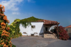
  • The trail ends at this point, La Rambleta, and on the left the Telesforo Bravo trail begins that will lead us to the peak. You can only walk through it with a special permit (see other information of interest). It is a high altitude, very steel section.
  • The summit is the mid point of Route 040. On a clear day you can see all seven islands and large part of the island of Tenerife. Once arrived at the summit, the return journey is along the same route, only in the opposite direction, which means we have to pass the itinerary points in reverse order.

IMAGE GALLERY

View all the pictures

Route video


Practical information

Realejo Alto – Chanajiga. PR TF 40


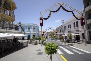
Starting point for this hike is the Viera y Clavijo square right next to one of the most festive streets of the municipality: The “calle el Medio de Arriba”. This street and the “calle del Sol”
are the centre of one of Europes biggest pyrotechnical shows. It takes place on every 3rd of
May during the festival of “Crosses and Fire in May” in Los Realejos.

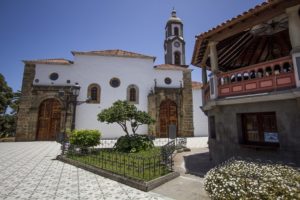
Important points of reference are the municipal Office of Tourism and the church of the Apostle St. james, which was the first Christian church on the island. On the other side of the road is the old town hall, built by Juan Margarit Serradel in the seventies of the past century and which currently holds the municipal library “Viera y Clavijo”.

The main part of this trail follows the channel of the La Lora ravine through the “Corona Forestal” nature reserve which has a surface area of 46,613 hectares and is hence the largest protected nature reserve of the Autonomous Community of the Canary Islands.

On our way up to the recreational area of Chanajiga we come across a number old roads and paths, houses and other interesting buildings that tell us how the lives of the residents of the area were completely connected to the environment.

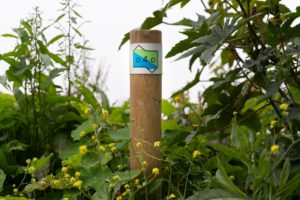
It is worth mentioning that this trail is registered and complies with European regulations. The standardised waymarks that we will find along the way consist of two parallel stripes, white on top and yellow below, this being a short path.

Route map

Apuntes de interés

Flora y fauna


The escarpments along the slopes of Tigaiga which are practically bare of vegetation are ideal nesting areas for birds that nest in crevices and on ledges. Surrounded by less steep slopes where laurel forest and thermophile shrubbery grow, these cliffs have numerous
natural ridges and cavities that are used by birds for nesting. While the common bussard (buteo buteo) is probably the most conspicuous bird of prey in this area due to its wingspan, you can also find common kestrels (falco tinnunculus) and Barbary falcons (falco pelegrinoides).


We must also not forget that these escarpments, especially the ones covered in vegetation, are excellent nesting grounds for the endemic Laurel pigeon (columba junoniae) and Bolle’s pigeon (columba bollii), the two endemic species of the Canary Islands that are associated with the laurel forest and shrublands.


In the less steep ravines, slopes and escarpments shrubbery grows that mixes with the pine woods at higher altitudes. A great number of invertebrates that can only be found on the islands live in these areas: among others land snails of the genus hemicycla, beetles and
millipedes.


As far as birds are concerned, one of the most characteristic but at the same time most elusive bird in these surroundings is the Eurasian woodcock (Scolopax rusticola).

Route Description

  • We set the starting point at the Viera y Clavijo square, opposite the Los Realejos Municipal Tourist Office. Here stands the church of the Apostle St. James, Tenerife’s first Christian church. The first account of the existence of this site, dedicated to the apostle St. James, is given because this is the place where the historic capitulation of the Guanche menceyes took place in the spring of 1496, on the land taken by the conquerors in the Taoro territory.


    According to ancient tradition, followed by the poet Antonio de Viana and the historians Juan Núñez de la Peña and José de Viera y Clavijo, the nine Guanche kings as well as many other important aboriginals, received baptism in the carved stone baptismal font.

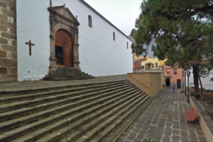
    The church of Apostle Saint James was declared National Historic Monument and Cultural Heritage in the monuments category in 1983. The line formed between the Viera y Clavijo square and the street “Calle El Medio de Arriba” shows a view reminiscent of the traditional old town centre which today has disappeared. Every year in July the traditional “Jacobean Pilgrimage” to Santiago del Teide parts from this square.

    Crossing the street we can enjoy a beautiful view from the outlook on the Plaza de la Unión, just above the Municipal Office of Tourism, or visit the municipal library Viera y Clavijo, whose building was used as the town hall before moving to its current location.
  • Exiting the square along one side of the library we can find a signboard with a map of the trail. A bit further we reach the road crossing with calle Godínez.

    This street crosses the ravine of the same name and can takes us either down to Realejo Bajo or to the house that is the birthplace of Viera y Clavijo. The house still has its original façade and can be found going up to the left in the street of that same name, that used to be called “Calle del Agua” (Water Street) where water gathered from the various springs was channelled to the sugar mills of “Realejo de Abajo”.
  • Back on the trail we continue upwards along Calle El Medio passing by the municipal consumer and local development offices to our left, which are located in the building where the old town hall of Realejo Alto used to be.

    A few metres further on, on the same side of the street, we find the Viera cinema, a building in Neocanarian style that was built during the late nineteen-forties by the acclaimed architect José Enrique Marrero Regalado. At the moment the building is closed waiting to be refurbished from the ground up.
  • We continue upward a little more than 300 metres, leaving behind us the road crossing that goes to Icod El Alto, before which, however, we find the Hotel Rural Los Realejos, a quality hotel that is housed in a meticulously renovated 17th century Canarian building.

    If we turn right and continue for another 50 metres until we reach the edge of the ravine, we can see two large protected centenarian trees: a Canary laurel and a Canary Island pine tree.
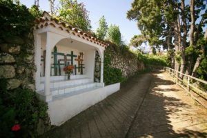
  • Back on Calle El Medio de Arriba we continue climbing until we reach the cross chapel and from there on continue upwards leaving the chapel on our left side and reach the street Calle Las Toscas de Romero.

    The crosses on Calle El Medio de Arriba and Calle El Sol are central to the municipality’s most important festival: Crosses and Fires of May (the first festival to be declared of “touristic importance” in the Canaries and of “national touristic importance” in 2015) which takes place on every 3rd of May and displays one of the biggest pyrotechnical exhibitions in Europe.
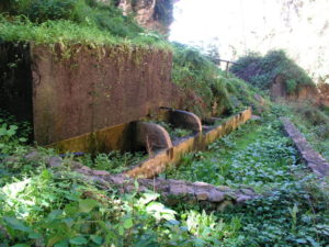
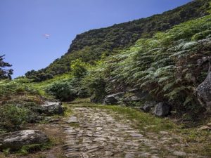
  • We leave the crossing of Las Toscas de Romero to the left and continue to the right toward barranco La Lora (“La Lora” ravine). Just a few metres further on, on the left hand side we find a centuries old trough that supplied water to locals and passing livestock. The asphalt road turns into an old, stone paved roadway (one of the few that still exist in the area) and once this ends we continue uphill along a cement path through the ravine’s channel.


    On the left we can see a slope covered in a great variety of plant species, such as Canary laurels, rumex, prickly pears, bamboo, Canary Island St. John’s wort and tree houseleek. Soon afterwards we arrive at a crossing with a path to the right that leads to the hamlet of Caserío del Tanque de Arriba. At this point we can see three stone columns that formed part of an old aqueduct. We continue our advance and cross the channel.
  • Along the way we find some prefabricated installations that the locals use for animal corrals.

    Various fruit trees appear alongside the path and among them a small entrance that opens to the left that leads to the old La Lora washing place, nowadays overgrown with vegetation.
  • We continue the ascent to the left, leaving to the right the path that goes up to the “Asomadero”. At this point we encounter a landscape with a vegetation that is the result of man made changes in the ravine. In the 20th century there were projects that envisioned the construction of a reservoir in this place.

    These were never finished but have left their mark on this place. We leave the Garabato ravine to the right and continue along the La Hondura ravine on the left.
  • The path leads us up to a large coniferous tree that rises from the foot of the Florida Baja water gallery. It should be remembered that it is prohibited to enter the water galleries. In many of them gases are emitted that are toxic for humans.

    From here on the trail leads us to the left where we begin the ascent beneath stone walls and passing alongside terraces that once were used for farming.

    A stretch with steps takes us over the La Hondura hillock from where we can hear the calls of the common buzzards in flight. We continue past the old farming areas which today are overgrown, mainly with fern and brambles.
  • Passing through stretches with heather and chestnut trees we arrive at a path on the right that leads to the hamlet of La Florida or, as it is also known, Villanueva. A slight ascent over the cemented road that passes through this hamlet allows us to contemplate a variety of
    ornamental plants that were introduced by the locals.

    Just at the end of the hamlet we find a road that to the left would take us to Placeres and Palo Blanco.
  • Leaving the hamlet of La Florida or Villanueva behind we ascend the slope walking through private fields and arriving at a cemented path that narrows and continues, unpaved again, before reaching the La Florida track, where we turn left and walk along a stretch bordered by chestnut trees and picconias.

    We ignore the right hand path that leads into the hillside, to an area with water springs and species characteristic of humid areas, known as La Villanueva.
  • We return to the path on the right, in the area known as La Pasada de Romero, that in between chestnut trees takes us into a dense laurel forest. After a prolonged ascent we arrive at a crossing where we have to continue to the right. If we went left, we would be returning to
    the hamlet of La Florida and Placeres.

    From above we can see the rests of an old pig farm and next to that a chicken farm that is still
    operative.
  • We arrive at the Los Zarzales ravine and have to cross the channel to continue ascending on its left side. On the right we find a few Monterrey pines and eucalyptus trees.

    After an ascending stretch we arrive at a crossing where we take the right hand path. If we went left we would take the Camino de Los Zarzales road to arrive at Placeres, passing the Los Zarzales gallery and the La Calera ravine.From here on we enter the area with the most interesting vegetation where we can see persea indica, laurels, Canary laurels, small-leaved holly, Portugal laurel, laurestine, heather, wavyleaf sea lavender, pericallis, polycarpea, rooting chain fern, ironwort, wild asparagus,
    tree housleek and others.
  • About a hundred metres further up the path we arrive at the “Fuente del Til” (stinkwood spring) where we can see an impressive stinkwood, known as the “Los Pavos” stinkwood.

    In this area we can sometimes hear the noise made by great spotted woodpeckers, which is uncommon because this area is more of a stronghold for laurel forest pigeons.
  • A bit further up we reach a natural lookout called Risco de los Villanos from where we can enjoy spectacular views over the La Calera ravine, the Madroño hamlet and the slopes of the Orotava Valley in general.

    Here begins a descent in which we have to walk carefully. It leads us to the channel of a small ravine and takes us up a section with steps.
  • A good stretch of ascent further on we reach a crossroads where we have to continue climbing, taking the right hand path. The branch to the left would take us along the Camino de la Travesía to Las Llanadas, Madroño and Palo Blanco.
  • A bit further on, to the right, we get to an alternative branch of the PR TF 40.1 trail – Camino Punta del Risco – a steep path that leads to the track on the slope of Chanajiga.

    Here we can see a pretty Portugal laurel copse.
  • We continue upwards on a long winding stretch of steep slope over several hills. Among the vegetation we can find a few abandoned vegetable gardens. We arrive at another crossroads which to the left would take us to the hamlet of Madroño.

    We can see the La Zarza and La Calera ravines to one and the other side respectively.
  • Further up the path widens and becomes a forest road. At one of the bends we come across the junction that goes to the La Esmeralda water gallery.

    We continue along the old forest road until we arrive at the Chanajiga Recreational Area, where we can find information panels about the trail.
  • We continue our hike to the right until we arrive at a playground. Once there we take the path along the left side, right next to a stone wall.

    We begin walking up the first part of the old Camino de la Guarda, winding along a stretch beneath tree and shrub forest.
  • After a slope with several curves we continue along a relatively level stretch until we reach the forest road of Chanajiga after going down a few stone steps

    This track is shared with bicycles, horses and motor vehicles and belongs to the BICA network of trails through natural reserves.

    To the right we can see water channels from different water galleries that also help the forest brigades in case of fire.
  • We continue along the track under the trees until we pass the crossing with the PR TF 40.1 trail “Camino Punta del Risco” on our right. This trail can be a shortcut to abbreviate the hike and walk it in less time.
  • Following the marked road we arrive at Enrique Talg’s hut in an area known as “Risco de Miguel”. Next to the hut a small group of bencomias can be seen.
  • A few metres further on we take the path that appears on the right hand side and that descends down ramp with a wooden railing. This ramp takes us to another part of the old Camino de la Guarda path that leads to the Asomadero lookout.
  • After a winding stretch of trail full of fallen leaves and shrubbery we arrive at the Los Helechos (helecho = fern) spring that lies next to a large laurel which is flanked by rooting chain fern.
  • After passing this place we continue along the path that progresses through a forest of shrub and evergreen trees and and takes us to the crossing with the path that descends from the Pista General de Icod el Alto and where we turn right.
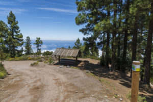
    We come across a cemented path that belonged to an old firebreak and is part of the old Camino del Lance trail that is in turn part of route 0 4 0. This route attracts an ever increasing
    number of mountain runners from all over the world. It sets off at Playa del Socorro beach, goes up to the summit of Mount Teide and fnishes back at the beach. A few metres further on we arrive at the Asomadero lookout.
  • At the crossing opposite the outlook we turn right, over the Asomadero hillside and descend down the steep and winding Camino Piedras del Lomo. This slope may be slippery so one needs to be extra careful so as not to fall.

    If we continue straight ahead we arrive at the track that, quite a bit further down and passing through an area known as “Fuente de Pedro”, reaches La Corona, another lookout with spectacular views, and where one of the island’s most important launching areas for paragliding is located. The Fuente de Pedro is a place where an ancient spring exists is an
    area that has been greatly affected by human action and by the offerings that are deposited there after the presumed appearance of the Virgin Mary in 1992.
  • As we walk down this long descent the shrubbery mixes with chestnut trees. Halfway down we arrive at a small lookout where we can rest and recover strength.

    Further down, the path turns toward the Lomo de la Tarasca leading along an impressive vertical cliff.
  • Coming out of the woods we turn right and walk through fields to arrive at an agricultural road that takes us to the next crossing.

    On this last bit we take the cemented path in the La Lora ravine and turning left descend along it until we reach the crossing that we passed at the beginning of our hike and that leads to Chanajiga. We descend to the left towards the starting area on the Viera y Clavijo square.

Image Gallery

View all images

Video of the route


Practical information

Barranco de Ruiz – San Agustín


The ravine called “barranco de Ruíz” comprises an area of 95.6 hectares and forms the border between the municipalities of San Juan de la Rambla and Los Realejos. In 1994 it
was declared “site of scientific interest” according to the Canary Islands Natural Areas act.

The scientific and conservationist interest of the area arises due to the natural elements and varied vegetation present here in form of laurel forest and thermophile forest, and also due to the rock-dwelling communities that still remain here.

With this trail we want to connect this emblematic site of the natural environment of Los Realejos with the rural world of Icod el Alto, the historic town centre of Realejo Bajo and San Agustín, one of the town’s vital districts. This is where the hike finishes and where the visitor will be able to find cultural, leisure and recreational centres, a shopping area and a large number of cafés, bars and restaurants.

Also in San Agustín is the shrine of Our Lady of Mount Carmel, perpetual honorary mayoress of Los Realejos and patroness of the Orotava Valley, which is a place of regular Marian pilgrimage.

Route Map

Apuntes de interés

Flora y fauna


In the Barranco de Ruíz ravine the capable observer will be able to spot all birds of prey that live on Tenerife, with the only exception of the osprey. This includes the diurnal species (common buzzard, sparrowhawk, kestrel and Barbary falcon) as well as nocturnal ones (barn owl and long-eared owl).


Several types of vegetation, from different altitudinal zones, especially laurel forest and thermophile thicket, overlap here making this natural depression an enclave for various species of Tenerife’s endemic land snails. Walking through the ravine during the flowering period of Canary bellflower and Canary foxglove – both of which are exclusive to the Canary Islands – we may have the opportunity to observe how small birds, among them leaf warblers and African blue tits, visit these flowers seeking the nutritious nectar. This is a mutually beneficial relationship: The birds obtain food and in exchange transport these plants’ pollen that sticks to the feathers of their heard to the pistils of other flowers in the vicinity.


Compared to a few decades ago, the presence of the two great Canarian endemic pigeons, Bolle’s pigeon and the laurel pigeon, seems to have increased. If you watch carefully you will be able to observe their energetic wing stroke or see them in flight.


The wooded part contains trees such as pleiomeris canariensis and stinkwood, but also many plants normally found at different altitudes, which are remarkable because of their rareness in this area. These are, among others, the wild tea plant and the pretty tree limonium.

Route Description

  • Very close to the point of departure is the land that María Abarca gave to Francisco de Ruíz in 1520. He built the original hermitage to the apostle Saint James which in 1594 was destroyed during a flood in the ravine.
  • We set out climbing  a set of recently built stone stairs on the west side of the resting area
    which take us to a stretch of trail that belongs to a private farm.

    Shrubs and bushes grow in this area, composed mainly of single Canary Island spurge, balsam spurge, rubia fructosa, periploca, tamarisk, morning-glory-tree, rumex, Kleinia nerifolia, tree houseleek, white viper‘s blugloss, Canary Island St Johns wort, dogfennel, Canary lavender, birdtongue and jasmine as well as wild olive and juniper which we passed
    walking through the resting area where they are planted. Coming on to the old trail we continue ascending leaving to the right stairs that lead to an old mill.
  • We continue ascending along stretches that are steeper and more stony, passing in front of a
    cave that is used as an animal pen at the foot of a great vertical cliff.
  • After passing these more difficult parts we reach a much more comfortable path, paved with stone and with stairs that takes us to the small square “Plaza de Pedro Domínguez” where we find the cross chapel of Los Rodríguez.

    From this small square we have a general view over the Barranco de Ruíz ravine. It is also a perfect place from which to observe birds of prey as well as the stacks of trachybasalt and phonolite with bands of tuff interspersed with red ochre deposits that can be found in the area.
  • We continue ascending on Calle Orilla de la Vera until we reach the road crossing of Carretera de La Vera Baja. We walk a few metres upwards along this road until we get to the cobbled road on the left that takes us back to the ravine.

    In this section of the trail we can see the transition of the vegetation that passes from the lower altitudinal zones to Canary Island fayal-brezal with Canary Islands St John’s wort, Ironwort, Sage, Kleinia neriifolia, thistles, flax-leaved daphne and Canary dandelion.
  • Crossing the ravine’s bed and entering the municipality of Los Realejos we reach a rather humid area along which we ascend through a stretch of great botanical interest containing species belonging to humid woods with brambles and willow shrubbery which turns into laurel forest with many species of trees and bushes. Among others there are picconias, Canary madrona, persea indica, visnea mocanera, laurel, Canary laurel, laurestine, hypericum grandiflorum, semele, Canary foxgloves, Canary Buttercup, Gesnouinia arborea, pericallis, wallflower as well as foreign species such as fig trees, chestnuts, danewort and red pea.

    Parts of this ravine are called “Barranco Hondo” (deep ravine).
  • Before entering the forest proper we take notice of two large centennial, listed Canary madrones, which are known as the madrones of La Fajana. We can reach them by walking a few hundred metres down a narrow lane to the left of the path, past the bed of the ravine and
    very close to the house and the water reservoir that we pass on our right.

    The place name “La Fajana” which can also be found in other parts of the municipality and on the Canary Islands in general, refers to level grounds at the foot of slopes or scarps that are formed by sediment falling down from the heights of those slopes.
  • We continue along a shaded and humid stretch where we find a large chestnut tree at the foot of which sits a rock shaped like a table that invites hikers to stop along the way.
  •  Continuing our walk we can see the cross of La Fajana. This kind of cross was put in difficult places and are a product of popular faith and a sign of sacralisation of these hard to reach stretches.
  • Further up we cross the bed of a ravine called Barranco de Castro in that area and pass below a waterfall which will carry more water in the winter months. We continue along the path that takes us to the ravine’s exit, flanked by bands of volcanic tuff and red ochre that passes through areas of Monterrey and Canary Island pine, a few andenocarpus viscosus, willow shrub and other humid forest species.
  • We arrive at the road down a cobbled path with beautiful views onto Teide. Turning right, we reach the “La Pared” estate, “Cruz de La Pared” and the road that takes us to the old laundry area in the Castro ravine that can also be visited.

    The communal laundry area is an interesting place where the local women went to wash laundry using the water from the nearby spring.

    The numerous crosses that appear along the road to the laundry area are testimony to the popular religiosity and evidence of the difficulty of navigating the Camino Real through this part of the ravine.

    The mansion of “La Pared” used to belong to the Castro family, alongside land that they had obtained during the conquest of the island. In his book “History of the Canary Islands”, José Antonio de Viera y Clavijo, famous polygraph born in Los Realejos, writes that this was the place where the first potatoes, imported from America, were cultivated in the Canaries.
  • We continue upwards to the next intersection turning left onto the Calle Real. The Calle Real on the right hand is the road – called Camino Real – that back in the day connected the whole area and would lead us to the rural hotel “Casablanca” (a refurbished, 18th century Canary mansion), the football field and the Icod El Alto cemetery.

    The Camino Real’s trajectory shows us the distribution of the population of Icod El Alto, which is divided into areas called quarters. First mentioned in documents dating back to the 17th century, seven such quarters are enumerated in the 20th century – the current number of them. The term denominates segments of settlement, some of them grouped together by roads, hamlets or strips of land.

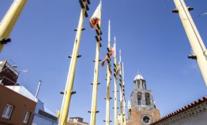
    On the south side of the church of Our Lady of Good Voyage, which we find at the end of this road there are seven flags (and an eighth one that corresponds to the village) that identify each of these quarters. This is thanks to a school project that was developed by the local school community.
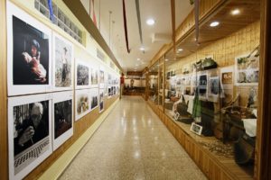
  • Following its course, we find, to the right side of this street, the Compulsory Education Center of La Pared. In the 80s of the past century this was where the Los Alzados Cultural Project was initiated. This is an interesting initiative by the locals to recover musical and other traditions of the area. In the front part of the building is the Los Alzados museum.

    This group was awarded the Canarian Popular Culture Prize in 2012.
  • Further down the street, we walk several hundred metres, leaving to the left the square of Poet Antonio Reyes until we reach the church in the centre of village, dedicated to Our Lady of Good Voyage. This church is documented as far back as the 16th century where it belonged to the parish of Our Lady of The Immaculate Conception in Realejo Bajo. It wasn’t until 1930 that it obtained its own status as parish.

    It is a modest building that has whose façade has been transformed quite a bit. Inside it houses interesting samples of Canary Art. We can highlight the clothed statue of the name giving patroness, the wood carvings of Saint Antony of Padua and Saint Joseph, as well as
    the paintings of Our Lady of Mount Carmel, Our Lady of the Rosary, Saint Margaret, the Calvary and Jesus Christ.

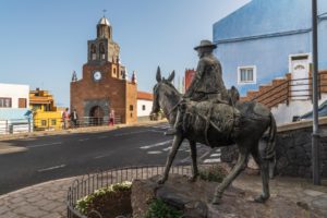
    On the other side of the road stands the sculpture in honour of the swineherds, made in bronze by Vidente Francisco García Palmero in 2008, inspired by the old trade of the swineherds of Icod El Alto.

    A break to refresh oneself or stroll through the shopping area of Icod El Alto is always recommended at this point.

    Just before arriving at the church we can opt to turn right onto the Carretera General TF-342 and visit the gofio mills in full operation. The gofio mills of Mesa and El Carmen lie a few hundred metres down that road.
  • If we follow along the proposed route, we have to go onto the the church square and cross it to reach a set of steps that takes us to the next intersection along a very steep road that used to be part of the old Camino Real. Turning right we continue to the end of Calle Calvario where, next to the small square Placita del Calvario, a small cement ramp begins that connects to a dirt track that we can see on the right.
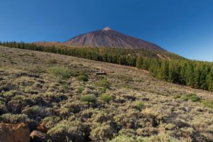
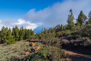
    In the past there used to be a old cross chapel here that was transformed in 1930 into the parochial Calvary. The image of Our Lady of Good Voyage is brought here by a procession every last Sunday of August.
  • Further along this road we find the old well and the laundry area Lavaderos del Dornajo, which receive their name from the very ravine they are located in. This path ends at the Carretera General de Icod El Alti TF-342 an the height of the road up to the hamlet of El Lance.

    Having belonged to the land of the conqueror Jorge Grimón, the well is mentioned as far back as the 16th century. Men and women of the area came here to collect water for their daily use.

    This ravine goes by the names of Barranco del Agua, Barranco Jorge Grimón, Barranco del Dornajo, Barranco Hondo and, its coastal section, Barranco de la Torre.
  • We turn left onto the side walk along the road in direction of the outlook of El Lance where we have impressive views of the Orotava valley and part of the island’s north coast.

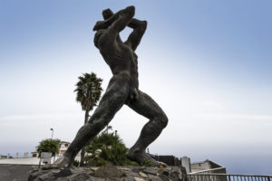
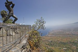
    At the outlook you can admire the monumental statue of Mencey Bentor. The bronze statue is the work of Carmen de Luís León (1996) and set here on this spot where, according to legends, the chieftain leapt down due to the last events that occurred before the island’s conquest.

    The valley that you can observe from here was formed when the volcanic materials that fille it suddenly collapsed and slid into the ocean. Beneath the outlook are flows of clinkstone that form steep cliffs of up to 80 metres height.

    In the hamlet of El Lance it was customary to play the “bucio” every time that it was known that an unmarried woman had become pregnant. The bucio is a large conch that was used by the aboriginal Canarians and was later used in popular Canary festivals.
  • We continue along the side walk leaving to the right a cemented ramp that leads to the Camino del Risco (aka Camino de La Baranda). Above this section is the cross of La Baranda on the side of the now disappeared Camino Real. This cross is not visible from the road.
  • Further along and to the left we will find the road “Camino Real de Las Vueltas de Icod El Alto” which his duly marked out. This road connects Icod El Alto with Realejo Bajo as was recovered after the whole area was declared nature reserve. Although not visible from the road, to the right is the spring of La Fuentita.

    This area is formed by sedimentary deposits from the cliffs with patches degraded evergreen shrubland and elements of laurel forest such as common and Canary laurel.

    The road called Camino de las Vueltas is an ancient road from Prehispanic times that connected the Icode and Taoro “menceyatos” as the territory ruled by a mencey is called. Until well into the 20th century this was the only road between Icod el Alto and Los Realejos. Travellers of the road told legends of witches and lights that would appear on the road early in the morning.

    Those legends and stories gave rise to news such as published in the newspaper La Opinión in 1905. It said: “On the road known as Camino de las Vueltas de Tigaiga, belonging to Los Realejos, there is a bramble that is admired by all travellers; it is said that from said bramble voices emerge that sound like those made by a phonograph, due to which the phenomenon
    has been named The Phonograph Bramble. Also remarkable is the fact that no sound can be heard during the day, but only from the onset of darkness until dawn.”
  • We descend along this cobbled road, leaving behind a first intersection that leads to the Camino de la Cantera, next to the ruins of a building on the left, locally known as the house of Mauina, where we find the Stone of Juan Pérez. This stone, named since the mid-16th century was a stop and resting place for weddings and funerals on their way to the Realejo Bajo parish. It was a milestone on the way and its peculiar form lent itself to this kind of recess.

    The character of Juan Pérez forms part of the imagery of the legends of Los Realejos. It is said that arriving at a huge bramble on the road of Las Vueltas on the edge of the road he heard voices emanating from its branches. He asked several time who was there and why they were picking berries at night, but no one answered. The next night, passing along the same bramble he heard the same voices… They were the voices of witches that spent the night eating berries.

    Below the Piedra de Juan Pérez, there is the Zapatero pond and the house at La Punta, nowadays very much changed. This house was a shop and a bakery, as well as a resting place and inn for travellers. Very close to this place was a basalt quarry where many cobblestones were quarried that were used to pave a great number of streets and squares in Tenerife.
  • Further down and past a house with a fence we arrive at the next intersection where we take the path to the left.

    If you prefer, you can carry on right in direction of Los Pinitos, a small cove of pines and other trees.
  • Towards the end of the descent the path becomes a street and we reach the intersection with Cruz del Aserradero.

    But before arriving a this point, and where today a block of flats stands, used to be the shop of María la Chacona. Thisis an important milestone on the Camino de las Vueltas due to the many colourful stories that took place there. Among all these stories, one of them is about how doña Matía, in times of prohibitions regarding the collecting of fire wood and dried pine leaves, let her neighbours know that the Guardia Civil was at her house. To this end she draped a white sheet over some stones, so that everyone coming down from the woods with fire wood knew to take an alternative route down to avoid the authorities from requisitioning it.

    “Asserradero” means sawmill and the place gets its name due to one having been located here. A stone with carved initials attest to the site. From here we can choose to continue along the recommended itinerary, following Calle Barroso, or enter the streets of Tigaiga.

    The optional visit to the district of Tigaiga invites you to visit some of its old houses, such as the Casa de La Era or La Cantera, its chapels and the hermitage of Our Lady of The Immaculate Conception, founded in 1617, next to what was once the Hacienda de La Fuente. A few metres from the hermitage is the old laundry place Lavaderos de Tigaiga, declared public utilities in 1701.

    Walking along the streets of Tigaiga you will encounter some very interesting examples of popular architecture, such as water taps installed in the 20th century to supply the locals, the cross chapels or the old cobbled roads. Very close to where the old quarry was located,
    which supplied a great number of stones for Tenerife’s churches, we can contemplate two interesting dragon trees.

    Three festivals take place in Tigaiga throughout the year: the Living Nativity Scene, more than forty years old, which runs along the entire vilage and in which many residents participate, the pilgrimage of San Antonio Abad, in the middle of the month of January and on the first Sunday in September the festivities of Our Lady of The Immaculate Conception, patron Saint of Tigaiga.

    Among its haciendas, the La Coronela estate stands out. Stories are known of noises and cries that can be heard in the early mornings in its halls and corridors. This emblematic building is very close to Asserradero, on the edge of the road that goes to Lomito Vaso, also called Camino Nuevo.

    It intersects with Calle La Paz on the left which is famous for the traditional puff pastry that has been made in Pastelería Paula since 1889.
  • We continue along Calle Barroso, leaving to the left the intersection with Calle Tigotán, and a few metres further on we find the cross chapel of Barroso, also known as the chapel of La Hoya. This is a new building that substitutes the old one constructed in the mid-20th century as yet another manifestation of the locals’ devotion.

    For those who love restfulness and nature, only a few metres away, to the left along Calle Los Quintos lies the idyllic rural tourist complex Finca El Quinto.

  • We continue walking east to arrive at Calle Los Príncipes that leads us into the heart of Realejo Bajo, whose town centre was declared to be of Cultural Interest in the category of0 Historic Set in 2005. Artistically, this town centre is the most important of Los Realejos because it conserves nearly 70% of its ensemble.

    Opposite the park La Parra we pass in front of the Hacienda Los Príncipes that belonged to the Adelantado mayor of the Canary Islands and thus named because through inheritance it belonged to the niece of the fourthAdelantado, Doña Porcia Magdalena Fernández de Lugo, wife of Don Antonio Luís de Leyva, third prince of Aculi and marquis of Atela. This haceinda had the first mechanised sugar mill in Tenerife, as well as mills (still standing and which can be reached goint up Calle Los Molinos), wineries and ponds. In 2009 it was declared of Cultural Interes in the category of Monument and in 2013 the scope was widened to include all the old water management systems that it still preserves.

    Following the Hacienda Los Principes lies the hermitage of Saint Sebastian, with its architecture that is typical of Canary buildings of this time. It was built by the locals in 1736 and inside is a simple altarpiece wit the image of the name giving saint connected to a pupil of José Luján Pérez.

    Opposite the hermitage is the Casa de La Parra or Casa de Los Lagares. This building originally belonged to the Hacienda de Los Príncipes, but today forms part of the cultural
    infrastructure of the municipality.
  • We follow the route along Calle Guillermo Camacho and Pérez Galdós until we arrive, a few metres further on, the church of Our Lady of The Immaculate Conception, the centre of this district from which several streets branch off that are remarkable for their steep slopes. We can contemplate their layout and architectural repertoire with buildings from the 17th through 20th centuries, mostly two stories high.

    Next to the church is the oldest staircase of the island (1570) which leads to the square of Domínguez Afonso where the Twin Dragon-trees of Realejo Bajo stand.

    An important point of reference in the area is the Hotel Rural Bentor, which is a perfect
    example of how rural tourism has allowed for the rehabilitation of mansions of historic interest.

    Also remarkable among the most well known and significant buildings is the parish house that dates back to the 17th century, with additions built in the 18th and 19th centuries. It was
    built in what is now the Calle El Cantillo de Abajo and has a beautiful balcony on its façade and a sturdy gallery that stands on teak pillars.
  • Arriving at the intersection between Calle El Cantillo de Abajo and Calle La Alhóndiga, we continue in a straight line along the former, leaving to our right hand side the old headquarters of the Musical Philharmonic Society of Los Realejos (the oldest musical group of the Canary Islands). We can observe several examples of eclectic architecture before reaching the square of the Shrine of Our Lady of Mount Carmel, situated in the centre of the district of San Agustín, where two of the three convents that the municipality had were founded.

    In 2008 this shrine, its square and the buildings connected to it were declared of Cultural Interest in the category of Monument.

    With the celebration of the 50th anniversary of the blessing and opening for service of the church of Our Lady of Mount Carmel, that took place on July 25th of 2015, it becomes the second shrine of Tenerife, alongside the Royal Shrine of Christ of La Laguna.

    Just in front of the square, in the street Calle San Agustín, you can again have a tase of the exquisite traditional pastry of Los Realejos at one of the branches of Pastelería Abuela Mercedes.
  • The last part of the route consists of a walk through these streets that invite you to visit the shopping area, or having a delicious meal at any one of the nearby restaurants or tascas.

Image gallery

Ver todas las imágenes

Video of the route


Practical information

Toscal – Playa del Socorro. “Sendero del Agua”


The trail known as “Sendero del Agua” – “the Water Trail” in English – is the result of efforts on behalf of the town of Los Realejos, during several decades, of bit by bit renovation of the old trails that were used by locals and fishermen to gain access to the coast.

Now, most of the expanse of the nature reserve of the Rambla de Castro with its different enclaves, can be visited on foot, and the beauty of the municipality of Los Realejos’ coast with its sand and pebble beaches, bays and natural pools can be appreciated. All this
within the protection of the reserve that was established in 1987, that received its current denomination in 1994, and has a surface area of 45.9 hectares.

This trail offers visitors the opportunity to take an interest in the area’s natural wealth, its fauna and flora and its need for preservation.

The trail leads into one of the most beautiful areas of the island, where nature, history, the landscape and legends merge in a journey sprinkled with beauty and with the always present murmuring of water.

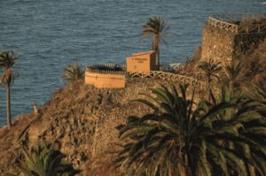
The famous palm grove, the Castro manor, San Fernando’s Fort and the pump station of la Gordejuela are essential waypoints on this trail, that tell us about the natural, historic, strategic and industrial importance of this place.

Route map

Apuntes de interés

Flora y fauna


If we pay a little attention along the way, we can observe the most representative passerines of the coastal areas of the island’s north, between Los Roques beach and the San Pedro lookout. Among the species and subspecies we can see here are the Eurasian blue tit and the leaf warbler, the Eurasian blackcap and the Sardinian warbler, blackbird, grey wagtail and the ever present Atlantic canary. Some of these small birds, but especially the leaf warblers and the Sardinian warblers, like to build their nests in the dense Canary incense that grows close to the house.


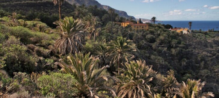
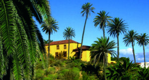
In the surroundings of the Rambla de Castro estate manor we find a large, apparently man made grove of Canary palm trees (Phoenix canariensis). In places the foliage creates a dense cover where leaves and trunks intertwine, forming a refuge for winged species such as the long-eared owl or certain types of bats.

From a geological point of view, and even delving into paleontology, a journey through this part of the island’s north coast offers insights into relevant and little known facts. With help of a specialist guide we can discover elevated beaches, the remains of large scale landslides,
the imprints of plants in rocky layers and molds of thermophile trees and bushes that were covered by ancient streams of lava.

Route Description

  • We start from the Church of Our Lady of Guadalupe en descend along the main road, passing through the Toscal-Longuera shopping area where we find shops and businesses.

    The parish church of Our Lady of Guadalupe was built by initiative of the parish priest
    Antonio María Hernández who was supported by the locals of the growing town centre of Toscal Longuera. It is a spacious building featuring the name giving saint which was made by the sculptor Ezequiel de León y Domínguez in the 80’s of the past century.

    The Toscal Longuera town centre emerges in the 20th century due to the large plantations of the area, especially those of the Gorvorana estate. Many houses for workers and day labourers were built along the road that went to Puerto de la Cruz. There are two distinct areas: La Longuera in the higher part and El Toscal in the lower. Urban development spurs the construction of the urbanisations of Los Potreros and Los Bancales as new areas for private construction and housing promotion in what is now one of the most densely populated areas of Los Realejos.

    The terms “Longuera” and “Toscal” refer to types of terrain. Longuera denominates long, narrow terrains, whereas Toscal refers to a type of soil.
  • Leaving the main road we turn left onto the street “calle Media Cuesta”. We descend along “calle El Cardón” to the intersection with the street “calle El Cedro”. Our walk through the sopping area of Toscal-Longuera takes us to the Cross Chapel of El Toscal, the religious reference point of that geographical area. The cross was installed there decades ago by the locals, next to the road and as a measure of spiritual protection for those who traveled through there.

    This cross is one of the many on the list of crosses of Los Realejos which is celebrated every
    year during the May festival of crosses and fire, which was the first festival to be declared of touristic interest in the Canaries.

    An the end of the street “calle El Cardón” and turning a few meters left into the “calle El Cedro” we can see from above the so called “Burgado” (top snail) cove, also called “Los Roques” beach. In this area, at the foot of a Canary Island date palm we can also find a water reservoir with its corresponding water management infrastructures.
  • We link up with a dirt track that takes us to a cemented path that runs between the fence of a banana plantation to the left and a concrete wall on the right. From here we can see the volcanic cones of “Montaña de la Horca” and “Montaña de Los Frailes”.

    According to the locals, this section belongs to a road called “camino Los Beltranes” which went through part of the lower portion of the neighbourhood and connected to the road “camino El Burgado”, as we shall see further on.

    This land, formerly dedicated to the cultivation of wine, currently grows one of the seven varieties of bananas that are cultivated on the islands. Depending on the time of year we pass by, we can observe the different stages of growth, bloom and production.
  • After getting to a dirt track we reach a section of stone paved path with a bit of a slope and curves through abandoned terraces, very close to the residential area of the Acapulco and Maritim apartments. A short section of this interesting paved trail remains which looks like it
    could have been an old “Camino Real” with appropriate width and shoulder construction. Without bein able to say so for certain, it could be part of the road known as “El Burgado” that connected Los Realejos and Puerto de la Cruz and led past the Gorvorana estate.

    Other interesting elements are preserved along this road, such as reservoirs, basins and small tanks that speak of a productive and generous agricultural past. In this area we can see vegetable gardens on terraces, now abandoned, old stone constructions with monk and nun style roofs next to new hotels, sports and leisure facilities.
  • We enter the road of “Playa de Los Roques” and turn left. We see a sign that warns of possible rockfall on this section and we pass to our right hand the path that goes down to the beach. We reach an intersection that to the right leads to the residential and hotel area, and
    to the left takes us down the proposed trail.

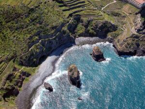
    On this section we can appreciate the beauty of Burgado cove or Los Roques beach, as it is
    also known. We have views to the “Roque Chico”, “Roque Grande” and “La Pata” rock formations which receive their names from their shapes and collective imagination. On the large rock – “Roque Grande” – existed a large population of Canary Island spurges which have all but disappeared nowadays, due to a number of causes such as nitrification of the soil and the excrement of the rather large population of rock doves. We know of interesting graphical documents, etchings as well as photographs, which depict boats at this idyllic place, possibly an anchorage close to port.

    Many of the plant species of this route can be observed here, among them: palm trees, dragon trees, olives and juniper, all of which are typical for the Mesocanarian level of vegetation or thermophilic forest. Also, tall-growing shrubs, such as: Canary Island spurge, balsam spurge, periploca, rubia fructosa, morning-glory-tree, danewort, Moquin’s marcetella, rumex lunaria, echium, kleinia neriifolia, and others of shorter growth, like dogfennel, frankenia, Canary dandelion, tree housleek, Canary lavender and pericallis.

    “Los Roques” beach is made up of pebbles and black sand and is popular with the locals. The best time to visit here is September because then the beach is completely covered in sand. We nevertheless have to warn of the danger from the sea currents that are present there.

    On the cliff we can see an old water canal: the “Aguas del Rey” canal. It was used to collect water that emerged from various points of the cliff and to conduct it down to Puerto de la
    Cruz.
  • Continuing along the path and passing to the right hand the trail that leads to the outlook of “La Poyata”, we continue up the cobbled section above “Los Roques” beach. In this area, also made up of old, abandoned terraces, we find interesting vegetation, especially Canary
    Island spurge and balsam spurge, without forgetting the fauna that inhabits this space.

    If we approach the viewpoint of La Poyata we can enjoy the panorama over the beach and also contemplate part of the north coast of the island, especially nearby Puerto de la Cruz.
  • The route now takes us to the streets of the urbanization of “La Romántica II” where to the right we have the streets called “calle Amapolas” and “calle Las Palmeras” and lastly “calle Los Geranios” where we turn right. We walk through this urbanisation which was built in the
    seventies of the past century, to expand of the tourist capacity of the municipality of Los Realejos and as an alternative for tourists that went to Puerto de la Cruz.

    Although we do not get to go there, it is interesting to know that a night club existed nearby called “Cueva Romántica” which was closed a long time ago, but well known and visited in its years of operation. It was built at the same time as the urbanization, taking advantage of an existing cave in the cliffs. Tourists from all over the island used to come here to enjoy the shows that were performed here.

    The gardens and recreational areas have been populated by numerous species that combine with the native flora. Thus we find washingtonia palms, araucarias, yuccas, bougainvillea and many varieties of ornamental flowers.
  • Reaching the intersection with “calle Los Geranios” we turn right onto the trail above the “Riscos de Mñendez” cliffs. The trail is initially flanked by tamarisks and bands of rough rock. We take the road along the lands known as Mendez’s. The name derives from the colonizer
    Juan Méndez who obtained a series of strips of land in this part of the island. Cultivated until a few decades ago, they are currently abandoned.

    The place name “Callao de Méndez” (Mendez’s shingle beach) and other names relating to rocks and places that fishermen know well, still remain, as they enter this area all year round to reach their favourite fishing grounds, which often has them crossing dangerous trails. We
    will also see some well preserved Canary Island spurges and other species of this coastal ecosystem accustomed to living on the steep cliffs.
  • We can stop at various turns of the road to contemplate the views of the coast that we have from these points. We can see all the way from the north-west coast, called “Isla Baja” to the shallows of El Pris in Tacoronte in the north-east.

    At certain, more salient areas the winding road takes us to outlooks where we can appreciate the beauty of the landscape that the north coast of the island of Tenerife offers with its steep cliffs, escarpments and dried watercourses.
  • Before we reach the wooden bridge of the Gordejuela or Palo Blanco ravine, we find an optional exit that leads to calle Buganvilla and to the Romantica I urbanisation to the left. After crossing the bridge we climb up a stone paved slope ro the La Merina road and a cement trail that takes us to the Gordejuela rural house, leaving the road down to the semiderelict Gordejuela pump-station to the right.

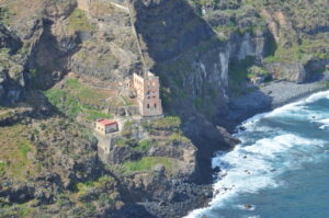
    We reach the edge of the Gordejuela ravine, where we can see part of the coast of the Rambla de Castro. From here we have an excellent view of the Gordejuela pump-station. The presence of water in the area and the need to collect it was what led to the construction of the pump-station. From above the ruins of the station, the visitor can appreciate the impressive architecture of the abandoned building. It was built by the engineer José Galván
    Balaguer by commission of the house of Hamilton. The boilers were placed 100 meters from the building with a tower 43 meters high, as well as pipes and steam engines that were the first on the island of Tenerife. Construction began in November 1903 and ended in June 1907.
  • Leaving La Gordejuela Rural House behind us, the road of La Merina leads us to a crossroads where we turn to the right, entering the Siete Fuentes estate to explore the cliffs of the coast of La Fajana.

    If we continue up the “camino de La Merina” we can reach Las Toscas de San Agustín and Puerto Franco street.

    On the way we pass old farmland, some of it within the estates of the aforementioned Juan de Gordejuela and know as the Patronage, due to his foundation for the maintenance of the convents he established in the municipality. Much of it is currently abandoned but in the past it was used to cultivate ornamental plants and flowers.

    To the left, at the beginning of our descent, we can see a number of caves with walls of rough stone that were used as temporary housing and storage for crops and farm utensils of the
    surrounding farms.
  • We descend into the Godinez ravine, passing over a small bridge that allows us to stand right above the centre of the ravine’s bed. From here we go into the Rambla de Castro. Godínez is just one of the names that the ravine receives along its route. It is the result of several
    tributaries that come together from the summits down to the sea and go by the names of “La Calera”, “La Lora”, “Godínez”, “La Fajana”, “del Agua”. In the past it was also known as “de Agustín de León” and “Barranco Hondo del Señor San Sebastián”. We can appreciate its depth and the amount of water that flows down it in rainy times by observing the erosion of the bed’s stony ground.

    At the beginning of the seventies of the 20th century, a series of paranormal events took place in this ravine, that were reported by the press throughout Spain. Strange noises emanated from a cave whose origin, however, was never determined, because there were a number of different versions about them. Hundreds of curious people visited the place for several months to find out what was going on. The phenomenon is known as the “Monster of San Vicente”.
  • We continue along the main trail and pass the descent to La Fajana beach to the right.

    The place name “La Fajana” which can also be found in other parts of the municipality and on the Canary Islands in general, refers to flat areas that formed at the foot of slopes and escarpments, from sediment of those hillsides.
  • From the left arrives the track that comes from the large Indian laurel located on the main trail and we go to the palm grove of the Rambla de Castro, past a new road that appears on our left.

    Continuing along the main path we get to locate ourselves above the San Fernando’s fort. From this projected position we can contemplate the beach of Castro on one side and the beach of La Fajana on the other, with the ruins of the Gordejuela pump-station in the background.
  • From here we can descend to the San Fernando’s fort outlook. This fort is one of three coastal batteries that existed along the coast of the of municipality of Realejo Bajo. It was built in 1808 to protect the population from pirate attacks. Of the original five cannons, three still
    remain intact.

    In this area we walk among balsam spurge, morning-glory-trees, clary sage, a few junipers and re-planted wild olives.
  • Continuing on our way we pass three intersections that take us to the entrance to the fort and toward the old trail that takes us to the dragon tree of the Rambla de Castro and the palm grove.

    We can appreciate the natural richness of the place, especially in this area where the largest number of palm trees is concentrated, most of them centenarians. The dragon tree (dracaena draco) could be about 150 years old, looking at its branching an the appearance of its trunk. It is possibly one of the few surviving in this place, since we are in an area well suited for its proliferation, and this one being one of those in Los Realejos which is situated closest to the sea.
  • Following the main trail, we pass on the right the path that goes down to the beach of Castro and also leads to the fort, and a few meters further on, on the left, we find one of the intersections that leads to the spring “Madre del Agua” (“mother of water” in English).

    Several travelers spent some time at the Castro estate manor, thanks to the generosity of the Bethencourt y Castro family, who inherited the old estate. Among them Sabino Berthelot or Jean Mascart who offered literary descriptions of the area.

    Between 1820 and 1830 Sabino Berthelot said: “After a short distance you get to the Rambla de Castro where you meet a different landscape. The work of man has
    complemented nature and converted this beautiful place into a pleasant residential space. Then, leaving these groves and the evocative labyrinth to the right, the scenery changes again, ahead there is only a stony beach; behind of which a wall of basalt towers over it as if it wanted to bury the beach under her powerful mass.”

    Jean Mascart in 1910 wrote the following: “Soon we arrived at the Rambla de Castro, the best known of these ravines and one of the deepest. It never lacks water and the vegetation is splendid. It forms a corridor between walls covered with ferns and mosses, with trickles of limpid water, a series of terraces and small bridges to cross from one to the other. It is a ravine in Eden. Along fallen trunks and flowers, butterflies and insects swarm among the babbling waterfalls. Below, there are banana plantations. The light is exquisite
    and soft, sifted, between the hot sun and the ocean that resounds with violence at our feet. Once again we have to separate ourselves from this unforgettable show. Now nature shows itself more beaming than ever.”
  • We continue along the main trail and reach the “Hacienda de Castro”. This is an interesting building with various constructions built in various stages over the centuries. It was founded by Hernando de Castro, “El Viejo” (the Elder) on land obtained after the conquest of the
    island had finished. Years later, the Majorat is founded and the hereditary line begins, with the brothers José and Agustín Bethencourt y Castro operating the estate during the 19th century.

    The house, built around a central courtyard is up to three stories high on some sides, making for a large, capacious building. Remarkable items of this construction are the wall with battlements, the basins for laundry, benches, settees and some old winepress-stones that belonged to presses that no longer exists today.
  • From the house we go upwards along the cobbled trail and turn right, leaving the main path to enter a stretch with palm trees.

    If we continue along the cobbled trail, to the left we will find the entrance to the “Mother of Water”, a spring that still emanates water which his collected in a reservoir for later usage. Inside the ravine, where the caves are from which the water comes, we can find a specimens
    of willows and other plants that thrive in humid environments.

    Further along the stone paved trail is a large Indian laurel which was possibly planted there in the 19th century, when the area had gardens and paths and resting places were created, and plants from other parts of the world were introduced. Very close to this place is a cave – now walled – that is said to have once been inhabited by natives.

    As far as animal life is concerned, in this specific area we can encounter birds such as leaf warblers, blackcaps and Sardinian warblers, common blackbirds, gray wagtails, common canaries and Eurasian blue tits, as well as nocturnal birds, like owls.
  • After walking across a short, wooden gangway we reach the old Mayorazgo road and ascend to the left.

    To the right is a path that goes to the natural pools of “El Guindaste”. The Mayorazgo road leads us past orchards and simple buildings until it gets to the sugar mill’s goods station and the cape of “El Guindaste”. Here the production of the sugar mill from “El Adelantamiento” and “Castro” as well as the produce from the surrounding farms were loaded onto ships. The name “guindaste” denominates a construction made of three poles and a rope which was
    used to load and unload the boats (a type of jib crane).

    There used to be another coastal defense fortress with canons in this area. Today it is visited by many bathers, fishermen and diving enthusiasts because from here you reach the shoal of Realejos with its enchanting submarine landscape.
  • Leaving the descent to “El Guindaste” behind us and after an ascending section, to the right we get onto stretch of even, paved road which we follow passing the continuation of the ascent that takes us to the San Pedro’s hermitage and the homonymous lookout.

    We walk on the old “Camino Real” along the coast which used to be the road that connected all the villages in the north of Tenerife. Its original cobble stones are still intact thanks to work sponsored by the Island’s government. One of the best preserved stretches is this one in Los Realejos.

    The Saint Peter hermitage must stem from the first years of the 17th century. Before then, another hermitage to Saint Peter existed in the “barranco de Ruiz” ravine, but that was destroyed during a flood. Construction is due to the owner of the Majorat, Pedro de Castro
    Navarro, who – according to documents – built it opposite the cross of Castro. The image of the saint that was made in Andalusian workshops, has the iconographic features conforming to an apostle. Every 29th of June a liturgical commemoration for the saint takes place where a beautiful arch is decorated with fruit and vegetables outside the hermitage.
  • We leave the cobbled road and walk along a paved street to the left, past the road that descends to the “Las Chozas” estate, cape “El Guindaste” and the urbanisation of “Ramblas del Mar”. The “Las Chozas” hacienda is an interesting building with a wide wooden gallery and roof tiles, open to the old road of “El Guindaste”, nowadays called “Ramblas del Mar”. It is known to have belonged to the majorat founded by Luís Benítez del Hoyo in 1598. In those days it consisted of several houses, winery and a water reservoir. It extended from the cliffs down to the ocean.

    The place known as “Punta del Guindaste” was sold in the mid-20th century to construct houses in the area of “Ramblas del Mar”. Since then it has become one of the most sought after areas in the north of Tenerife. Constructed with simple, two-story houses it sits above the natural pools of “El Guindaste”, in a privileged location due to its climate.
  •  At the next crossroads we continue, following the road to the right, passing between the “Hacienda de las Cuatro Ventanas” estate on the left and the road that leads to the “Hacienda de La Rambla” on the right, between banana plantations.

    The house “Las Cuatro Ventanas” belonged to the families of Vergara and del Hoyo and later became property of the marquis of Celada. An ample complex made of two buildings with the windows facing north and a series of annexes on the south side. Nowadays it serves as tourist accommodation.

    The estate known as “La Rambla” is made up of a group of simple buildings used as homes for owners and leaseholders. In the past it had a winery and cellars as well as a porch and an ample courtyard. Banana farming has influenced the use of the land as well as the shape of the infrastructure. An interesting specimen of dragon tree exists in this area: the dragon tree of “Rambla del Mar” with a slender canopy that extends over a sea of banana plantations.
  • Very nearby we can find the road of “Los Morales” to the left that comes from Tigaiga and that leads us to the hacienda of the viscount of Buen Paso.

    Next to the “Los Morales” (blackberry) road, which conserves its name although no blackberries exist in the area any more, stands the estate that belonged to the viscount of Buen Paso and the marquis of San Andrés. It used to have housing for the leaseholders, a
    garden and the main house with a U-shaped floor plan and a courtyard that is divided by a wall after the property was sectioned in 1863.
  •  We continue along the road to Socorro beach, between banana plantations, passing the farms of Babón and El Socorro on our left, where the main house and the hermitage of Our Lady of Perpetual Help is located.

    Bananas have been farmed there since the 19th century, thanks to the commercial estates that started exporting them to the European markets, especially to England. Despite the passage of time and the abandonment of some of the productive lands, the farms of La Rambla continue to be a reference for banana cultivation on the island of Tenerife.

    In the Babón area stands the hacienda “El Socorro” which derives its name from the hermitage built in honour to Our Lady of Perpetual Help around 1617. Inside stands a full sized statue in front of an altarpiece with the portraits of the founding family.
  •  We reach the Socorro beach with its black sand that is popular because of its clean water and to practice water sports such as bodyboarding and surfing . At this final point in the itinerary the hiker can go for a refreshing swim in the clear waters of the beach, rest, have a snack at the Kiosko Doña Carmen or a meal in the restaurant at the beginning of the promenade.

    The Socorro beach is named after the nearby estate and hermitage. This area used to be a lush retreat for the locals until the track and later the road were built in the second half of the 20th century which is when this place gained popularity. Years later it became one of the most important areas on the island for surfers.

    It has received the European blue flag for the past two years running due to the quality of its water, the cleanliness of the area and the services it offers.

    There is mostly shrubbery in this area, typical of the coast zone, among which we find the following species: tamarisk, sea lettuce, frankenia, dogfennel, eternal flower, rumex lunaria and Canary dandelion.