
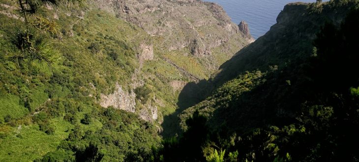
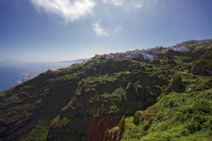
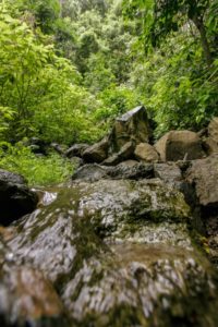
The ravine called “barranco de Ruíz” comprises an area of 95.6 hectares and forms the border between the municipalities of San Juan de la Rambla and Los Realejos. In 1994 it
was declared “site of scientific interest” according to the Canary Islands Natural Areas act.
The scientific and conservationist interest of the area arises due to the natural elements and varied vegetation present here in form of laurel forest and thermophile forest, and also due to the rock-dwelling communities that still remain here.
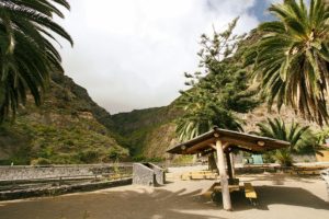
With this trail we want to connect this emblematic site of the natural environment of Los Realejos with the rural world of Icod el Alto, the historic town centre of Realejo Bajo and San Agustín, one of the town’s vital districts. This is where the hike finishes and where the visitor will be able to find cultural, leisure and recreational centres, a shopping area and a large number of cafés, bars and restaurants.
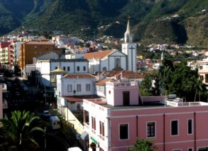
Also in San Agustín is the shrine of Our Lady of Mount Carmel, perpetual honorary mayoress of Los Realejos and patroness of the Orotava Valley, which is a place of regular Marian pilgrimage.
Route Map
Apuntes de interés
Francisco de Ruíz
Close to the point where we set out used to be the land that María de Abarca gave to Francisco de Ruíz in 1520 and from whom the ravine receives its name.
The La Fajana Canary Madrones
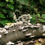
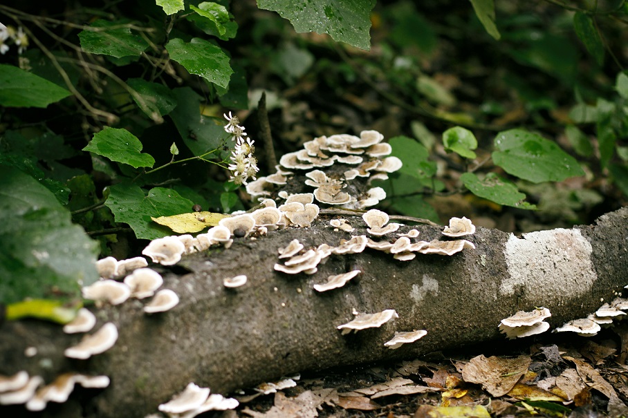
With its three main branches and a side branch this is one of the largest Canary madrones of the islands. Its brittle bark breaks off in large chunks, as is common for this species.
Two more of these trees stand nearby. They stand about 100 metres away from the “Casa de La Fajana”. They can be reached via a trail down to the “Barranco de Ruiz” gorge from calle La Fajana in Icod el Alto.
La Fajana
The place name “La Fajana” which can also be found in other parts of the municipality and on the Canary Islands in general, refers to level grounds at the foot of slopes or scarps that are formed by sediment falling down from the heights of those slopes.
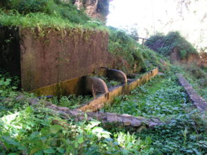
Castro Ravine Wash Basins
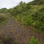
The washing places of the Castro ravine are interesting, communal washing places which were used by locals using the excess water from the nearby waterfall
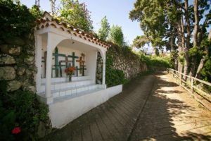
Crosses on The Way
The many crosses encountered along the way were placed in spots that are difficult to pass and constitute an expression of popular faith with which those hard to access places are sacralised.
The Estate of “La Pared”
The La Pared estate used to belong to the Castro family on the land obtained after the island’s conquest. According to Viera y Clavijo it was on this land where in 1622 the first potatoes of the Canary Islands were cultivated.
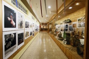
The Museum of “Los Alzados”
The museum “Los Alzados” is situated in the Centre for Compulsory Education of La Pared. It is the fruit of an initiative initiated by locals to recover and preserve the traditional music and way of life. It obtained the Canary Award for Popular Culture in 2012.
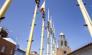
The Church of Our Lady of Good Voyage
The Church of Our Lady of Good Voyage appears in documents from the 16th century. It is a modest building that houses interesting examples of Canary art.
The Quarters of Icod El Alto
In the 18th century Icod el Alto was divided into quarters and by the 20th century seven such quarters are counted. They are subdivisions of the town centre that remain even today.
Traditions of El Lance
There used to be a tradition in the El Lance hamlet whereby a conch (the shell of a sea snail that the native Canarians used during their festivities) was blown every time it was known that an unmarried woman had become pregnant.
el Lance Outlook
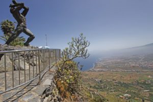
The monumental bronze statue of Mencey Bentor, made by Carmen Luís León (1996), is situated at the outlook of El Lance at the spot where according to legend the chieftain jumped off the cliff in consequence of the last events prior to the island’s conquest.
“Las Vueltas” of Icod El Alto
The trail of Las Vueltas is an old road from aboriginal times that connected the Guanche principalities of of Icode and Taoro. Until well into the 20th century it was the only connection between Icod el Alto and Los Realejos.
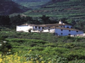
Hacienda Los Principes
The estate of Los Príncipes belonged to the Adelantado’s fourth niece, Doña Porcia Magdalena Fernández de Lugo, wife of Don Antonio Luís de Leyva, thrid prince of Asculi and marquis of Atela. The first sugar mill of Tenerife was situated here and it was declared cultural heritage in the monuments category in 2009.
The Oldest Stone Stairs of Tenerife
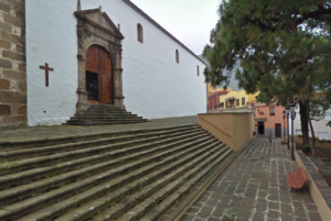
The church of Our Lady of the Immaculate Conception was declared cultural heritage in the monuments category in 2003. Next to it, facing the Domínguez Alfonso square is the island’s oldest stone stairs (1570).
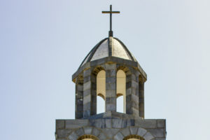
Shrine of Our Lady of Mount Carmel
On the 50th anniversary of its blessing and opening for service the church of Our Lady of Mount Carmel becomes the second shrine on the island of Tenerife, next to the Royal Shrine of Christ of La Laguna.
Flora y fauna
In the Barranco de Ruíz ravine the capable observer will be able to spot all birds of prey that live on Tenerife, with the only exception of the osprey. This includes the diurnal species (common buzzard, sparrowhawk, kestrel and Barbary falcon) as well as nocturnal ones (barn owl and long-eared owl).
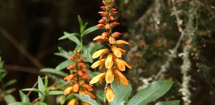
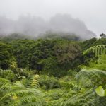
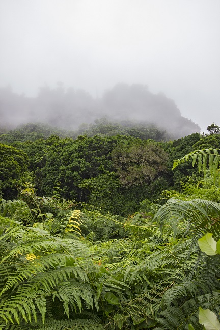
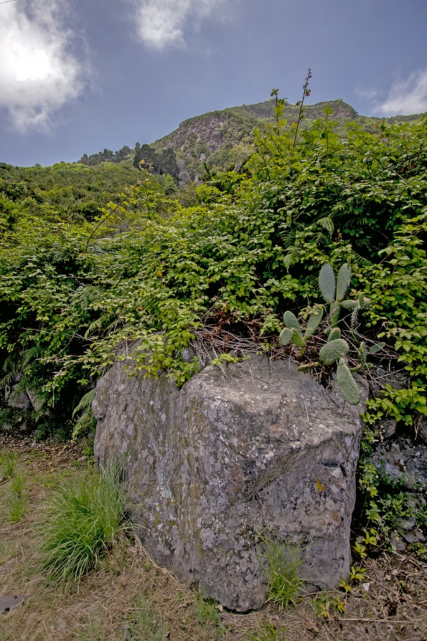
Several types of vegetation, from different altitudinal zones, especially laurel forest and thermophile thicket, overlap here making this natural depression an enclave for various species of Tenerife’s endemic land snails. Walking through the ravine during the flowering period of Canary bellflower and Canary foxglove – both of which are exclusive to the Canary Islands – we may have the opportunity to observe how small birds, among them leaf warblers and African blue tits, visit these flowers seeking the nutritious nectar. This is a mutually beneficial relationship: The birds obtain food and in exchange transport these plants’ pollen that sticks to the feathers of their heard to the pistils of other flowers in the vicinity.
Compared to a few decades ago, the presence of the two great Canarian endemic pigeons, Bolle’s pigeon and the laurel pigeon, seems to have increased. If you watch carefully you will be able to observe their energetic wing stroke or see them in flight.
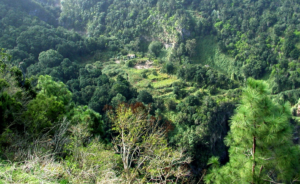
The wooded part contains trees such as pleiomeris canariensis and stinkwood, but also many plants normally found at different altitudes, which are remarkable because of their rareness in this area. These are, among others, the wild tea plant and the pretty tree limonium.
Route Description
- Very close
 to the point of departure is the land that María Abarca gave to Francisco de Ruíz in 1520. He built the original hermitage to the apostle Saint James which in 1594 was destroyed during a flood in the ravine.
 - We set out climbing
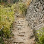
 a set of recently built stone stairs on the west side of the resting area
which take us to a stretch of trail that belongs to a private farm.Shrubs and bushes grow in this area, composed mainly of single Canary Island spurge, balsam spurge, rubia fructosa, periploca, tamarisk, morning-glory-tree, rumex, Kleinia nerifolia, tree houseleek, white viper‘s blugloss, Canary Island St Johns wort, dogfennel, Canary lavender, birdtongue and jasmine as well as wild olive and juniper which we passed
walking through the resting area where they are planted. Coming on to the old trail we continue ascending leaving to the right stairs that lead to an old mill.
a set of recently built stone stairs on the west side of the resting area
which take us to a stretch of trail that belongs to a private farm.Shrubs and bushes grow in this area, composed mainly of single Canary Island spurge, balsam spurge, rubia fructosa, periploca, tamarisk, morning-glory-tree, rumex, Kleinia nerifolia, tree houseleek, white viper‘s blugloss, Canary Island St Johns wort, dogfennel, Canary lavender, birdtongue and jasmine as well as wild olive and juniper which we passed
walking through the resting area where they are planted. Coming on to the old trail we continue ascending leaving to the right stairs that lead to an old mill. - We continue ascending
 along stretches that are steeper and more stony, passing in front of a
cave that is used as an animal pen at the foot of a great vertical cliff.
along stretches that are steeper and more stony, passing in front of a
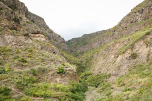
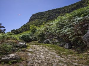
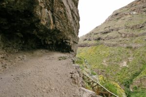
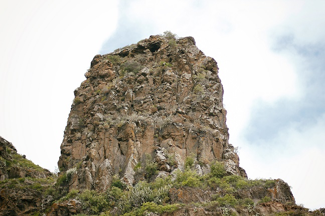
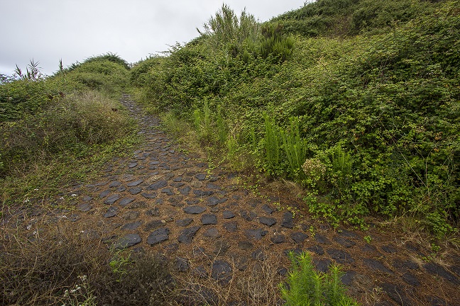
cave that is used as an animal pen at the foot of a great vertical cliff. 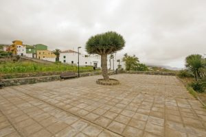 After passing these more difficult parts we reach a much more comfortable path, paved with stone and with stairs that takes us to the small square “Plaza de Pedro Domínguez” where we find the cross chapel of Los Rodríguez.From this small square we have a general view over the Barranco de Ruíz ravine. It is also a perfect place from which to observe birds of prey as well as the stacks of trachybasalt and phonolite with bands of tuff interspersed with red ochre deposits that can be found in the area.
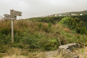 We continue ascending on Calle Orilla de la Vera until we reach the road crossing of Carretera de La Vera Baja. We walk a few metres upwards along this road until we get to the cobbled road on the left that takes us back to the ravine.In this section of the trail we can see the transition of the vegetation that passes from the lower altitudinal zones to Canary Island fayal-brezal with Canary Islands St John’s wort, Ironwort, Sage, Kleinia neriifolia, thistles, flax-leaved daphne and Canary dandelion.
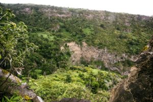
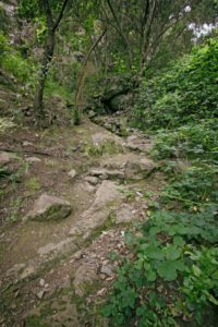 Crossing the ravine’s bed and entering the municipality of Los Realejos we reach a rather humid area along which we ascend through a stretch of great botanical interest containing species belonging to humid woods with brambles and willow shrubbery which turns into laurel forest with many species of trees and bushes. Among others there are picconias, Canary madrona, persea indica, visnea mocanera, laurel, Canary laurel, laurestine, hypericum grandiflorum, semele, Canary foxgloves, Canary Buttercup, Gesnouinia arborea, pericallis, wallflower as well as foreign species such as fig trees, chestnuts, danewort and red pea.Parts of this ravine are called “Barranco Hondo” (deep ravine).
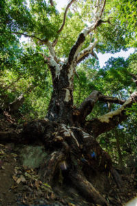 Before entering the forest proper we take notice of two large centennial, listed Canary madrones, which are known as the madrones of La Fajana. We can reach them by walking a few hundred metres down a narrow lane to the left of the path, past the bed of the ravine and
very close to the house and the water reservoir that we pass on our right.The place name “La Fajana” which can also be found in other parts of the municipality and on the Canary Islands in general, refers to level grounds at the foot of slopes or scarps that are formed by sediment falling down from the heights of those slopes.
Before entering the forest proper we take notice of two large centennial, listed Canary madrones, which are known as the madrones of La Fajana. We can reach them by walking a few hundred metres down a narrow lane to the left of the path, past the bed of the ravine and
very close to the house and the water reservoir that we pass on our right.The place name “La Fajana” which can also be found in other parts of the municipality and on the Canary Islands in general, refers to level grounds at the foot of slopes or scarps that are formed by sediment falling down from the heights of those slopes. We continue along a shaded and humid stretch where we find a large chestnut tree at the foot of which sits a rock shaped like a table that invites hikers to stop along the way.
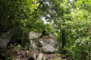 Continuing our walk we can see the cross of La Fajana. This kind of cross was put in difficult places and are a product of popular faith and a sign of sacralisation of these hard to reach stretches.
- Further up
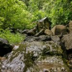
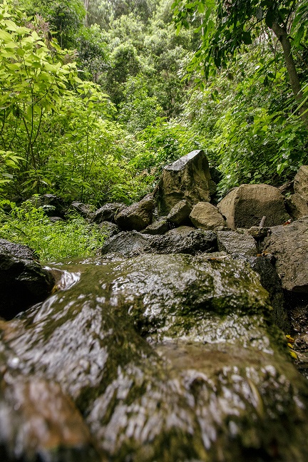
 we cross the bed of a ravine called Barranco de Castro in that area and pass below a waterfall which will carry more water in the winter months. We continue along the path that takes us to the ravine’s exit, flanked by bands of volcanic tuff and red ochre that passes through areas of Monterrey and Canary Island pine, a few andenocarpus viscosus, willow shrub and other humid forest species.
 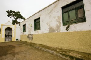 We arrive at the road down a cobbled path with beautiful views onto Teide. Turning right, we reach the “La Pared” estate, “Cruz de La Pared” and the road that takes us to the old laundry area in the Castro ravine that can also be visited.The communal laundry area is an interesting place where the local women went to wash laundry using the water from the nearby spring.The numerous crosses that appear along the road to the laundry area are testimony to the popular religiosity and evidence of the difficulty of navigating the Camino Real through this part of the ravine.The mansion of “La Pared” used to belong to the Castro family, alongside land that they had obtained during the conquest of the island. In his book “History of the Canary Islands”, José Antonio de Viera y Clavijo, famous polygraph born in Los Realejos, writes that this was the place where the first potatoes, imported from America, were cultivated in the Canaries.
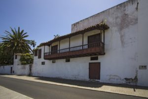
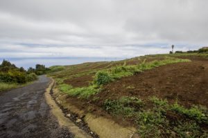 We continue upwards to the next intersection turning left onto the Calle Real. The Calle Real on the right hand is the road – called Camino Real – that back in the day connected the whole area and would lead us to the rural hotel “Casablanca” (a refurbished, 18th century Canary mansion), the football field and the Icod El Alto cemetery.The Camino Real’s trajectory shows us the distribution of the population of Icod El Alto, which is divided into areas called quarters. First mentioned in documents dating back to the 17th century, seven such quarters are enumerated in the 20th century – the current number of them. The term denominates segments of settlement, some of them grouped together by roads, hamlets or strips of land.On the south side of the church of Our Lady of Good Voyage, which we find at the end of this road there are seven flags (and an eighth one that corresponds to the village) that identify each of these quarters. This is thanks to a school project that was developed by the local school community.
 Following its course, we find, to the right side of this street, the Compulsory Education Center of La Pared. In the 80s of the past century this was where the Los Alzados Cultural Project was initiated. This is an interesting initiative by the locals to recover musical and other traditions of the area. In the front part of the building is the Los Alzados museum.This group was awarded the Canarian Popular Culture Prize in 2012.
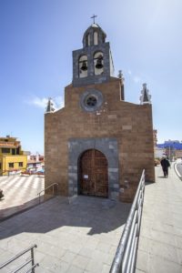 Further down the street, we walk several hundred metres, leaving to the left the square of Poet Antonio Reyes until we reach the church in the centre of village, dedicated to Our Lady of Good Voyage. This church is documented as far back as the 16th century where it belonged to the parish of Our Lady of The Immaculate Conception in Realejo Bajo. It wasn’t until 1930 that it obtained its own status as parish.It is a modest building that has whose façade has been transformed quite a bit. Inside it houses interesting samples of Canary Art. We can highlight the clothed statue of the name giving patroness, the wood carvings of Saint Antony of Padua and Saint Joseph, as well as
the paintings of Our Lady of Mount Carmel, Our Lady of the Rosary, Saint Margaret, the Calvary and Jesus Christ.On the other side of the road stands the sculpture in honour of the swineherds, made in bronze by Vidente Francisco García Palmero in 2008, inspired by the old trade of the swineherds of Icod El Alto.A break to refresh oneself or stroll through the shopping area of Icod El Alto is always recommended at this point.Just before arriving at the church we can opt to turn right onto the Carretera General TF-342 and visit the gofio mills in full operation. The gofio mills of Mesa and El Carmen lie a few hundred metres down that road.
Further down the street, we walk several hundred metres, leaving to the left the square of Poet Antonio Reyes until we reach the church in the centre of village, dedicated to Our Lady of Good Voyage. This church is documented as far back as the 16th century where it belonged to the parish of Our Lady of The Immaculate Conception in Realejo Bajo. It wasn’t until 1930 that it obtained its own status as parish.It is a modest building that has whose façade has been transformed quite a bit. Inside it houses interesting samples of Canary Art. We can highlight the clothed statue of the name giving patroness, the wood carvings of Saint Antony of Padua and Saint Joseph, as well as
the paintings of Our Lady of Mount Carmel, Our Lady of the Rosary, Saint Margaret, the Calvary and Jesus Christ.On the other side of the road stands the sculpture in honour of the swineherds, made in bronze by Vidente Francisco García Palmero in 2008, inspired by the old trade of the swineherds of Icod El Alto.A break to refresh oneself or stroll through the shopping area of Icod El Alto is always recommended at this point.Just before arriving at the church we can opt to turn right onto the Carretera General TF-342 and visit the gofio mills in full operation. The gofio mills of Mesa and El Carmen lie a few hundred metres down that road.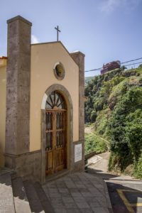 If we follow along the proposed route, we have to go onto the the church square and cross it to reach a set of steps that takes us to the next intersection along a very steep road that used to be part of the old Camino Real. Turning right we continue to the end of Calle Calvario where, next to the small square Placita del Calvario, a small cement ramp begins that connects to a dirt track that we can see on the right.In the past there used to be a old cross chapel here that was transformed in 1930 into the parochial Calvary. The image of Our Lady of Good Voyage is brought here by a procession every last Sunday of August.
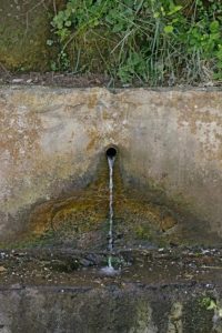 Further along this road we find the old well and the laundry area Lavaderos del Dornajo, which receive their name from the very ravine they are located in. This path ends at the Carretera General de Icod El Alti TF-342 an the height of the road up to the hamlet of El Lance.Having belonged to the land of the conqueror Jorge Grimón, the well is mentioned as far back as the 16th century. Men and women of the area came here to collect water for their daily use.This ravine goes by the names of Barranco del Agua, Barranco Jorge Grimón, Barranco del Dornajo, Barranco Hondo and, its coastal section, Barranco de la Torre.
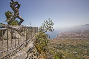 We turn left onto the side walk along the road in direction of the outlook of El Lance where we have impressive views of the Orotava valley and part of the island’s north coast.At the outlook you can admire the monumental statue of Mencey Bentor. The bronze statue is the work of Carmen de Luís León (1996) and set here on this spot where, according to legends, the chieftain leapt down due to the last events that occurred before the island’s conquest.The valley that you can observe from here was formed when the volcanic materials that fille it suddenly collapsed and slid into the ocean. Beneath the outlook are flows of clinkstone that form steep cliffs of up to 80 metres height.In the hamlet of El Lance it was customary to play the “bucio” every time that it was known that an unmarried woman had become pregnant. The bucio is a large conch that was used by the aboriginal Canarians and was later used in popular Canary festivals.
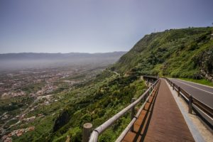 We continue along the side walk leaving to the right a cemented ramp that leads to the Camino del Risco (aka Camino de La Baranda). Above this section is the cross of La Baranda on the side of the now disappeared Camino Real. This cross is not visible from the road.
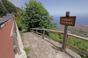 Further along and to the left we will find the road “Camino Real de Las Vueltas de Icod El Alto” which his duly marked out. This road connects Icod El Alto with Realejo Bajo as was recovered after the whole area was declared nature reserve. Although not visible from the road, to the right is the spring of La Fuentita.This area is formed by sedimentary deposits from the cliffs with patches degraded evergreen shrubland and elements of laurel forest such as common and Canary laurel.The road called Camino de las Vueltas is an ancient road from Prehispanic times that connected the Icode and Taoro “menceyatos” as the territory ruled by a mencey is called. Until well into the 20th century this was the only road between Icod el Alto and Los Realejos. Travellers of the road told legends of witches and lights that would appear on the road early in the morning.Those legends and stories gave rise to news such as published in the newspaper La Opinión in 1905. It said: “On the road known as Camino de las Vueltas de Tigaiga, belonging to Los Realejos, there is a bramble that is admired by all travellers; it is said that from said bramble voices emerge that sound like those made by a phonograph, due to which the phenomenon
has been named The Phonograph Bramble. Also remarkable is the fact that no sound can be heard during the day, but only from the onset of darkness until dawn.”
Further along and to the left we will find the road “Camino Real de Las Vueltas de Icod El Alto” which his duly marked out. This road connects Icod El Alto with Realejo Bajo as was recovered after the whole area was declared nature reserve. Although not visible from the road, to the right is the spring of La Fuentita.This area is formed by sedimentary deposits from the cliffs with patches degraded evergreen shrubland and elements of laurel forest such as common and Canary laurel.The road called Camino de las Vueltas is an ancient road from Prehispanic times that connected the Icode and Taoro “menceyatos” as the territory ruled by a mencey is called. Until well into the 20th century this was the only road between Icod el Alto and Los Realejos. Travellers of the road told legends of witches and lights that would appear on the road early in the morning.Those legends and stories gave rise to news such as published in the newspaper La Opinión in 1905. It said: “On the road known as Camino de las Vueltas de Tigaiga, belonging to Los Realejos, there is a bramble that is admired by all travellers; it is said that from said bramble voices emerge that sound like those made by a phonograph, due to which the phenomenon
has been named The Phonograph Bramble. Also remarkable is the fact that no sound can be heard during the day, but only from the onset of darkness until dawn.” We descend along this cobbled road, leaving behind a first intersection that leads to the Camino de la Cantera, next to the ruins of a building on the left, locally known as the house of Mauina, where we find the Stone of Juan Pérez. This stone, named since the mid-16th century was a stop and resting place for weddings and funerals on their way to the Realejo Bajo parish. It was a milestone on the way and its peculiar form lent itself to this kind of recess.The character of Juan Pérez forms part of the imagery of the legends of Los Realejos. It is said that arriving at a huge bramble on the road of Las Vueltas on the edge of the road he heard voices emanating from its branches. He asked several time who was there and why they were picking berries at night, but no one answered. The next night, passing along the same bramble he heard the same voices… They were the voices of witches that spent the night eating berries.Below the Piedra de Juan Pérez, there is the Zapatero pond and the house at La Punta, nowadays very much changed. This house was a shop and a bakery, as well as a resting place and inn for travellers. Very close to this place was a basalt quarry where many cobblestones were quarried that were used to pave a great number of streets and squares in Tenerife.
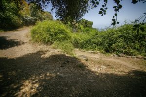 Further down and past a house with a fence we arrive at the next intersection where we take the path to the left. If you prefer, you can carry on right in direction of Los Pinitos, a small cove of pines and other trees.
 Towards the end of the descent the path becomes a street and we reach the intersection with Cruz del Aserradero. But before arriving a this point, and where today a block of flats stands, used to be the shop of María la Chacona. Thisis an important milestone on the Camino de las Vueltas due to the many colourful stories that took place there. Among all these stories, one of them is about how doña Matía, in times of prohibitions regarding the collecting of fire wood and dried pine leaves, let her neighbours know that the Guardia Civil was at her house. To this end she draped a white sheet over some stones, so that everyone coming down from the woods with fire wood knew to take an alternative route down to avoid the authorities from requisitioning it. “Asserradero” means sawmill and the place gets its name due to one having been located here. A stone with carved initials attest to the site. From here we can choose to continue along the recommended itinerary, following Calle Barroso, or enter the streets of Tigaiga.The optional visit to the district of Tigaiga invites you to visit some of its old houses, such as the Casa de La Era or La Cantera, its chapels and the hermitage of Our Lady of The Immaculate Conception, founded in 1617, next to what was once the Hacienda de La Fuente. A few metres from the hermitage is the old laundry place Lavaderos de Tigaiga, declared public utilities in 1701.Walking along the streets of Tigaiga you will encounter some very interesting examples of popular architecture, such as water taps installed in the 20th century to supply the locals, the cross chapels or the old cobbled roads. Very close to where the old quarry was located,
which supplied a great number of stones for Tenerife’s churches, we can contemplate two interesting dragon trees.Three festivals take place in Tigaiga throughout the year: the Living Nativity Scene, more than forty years old, which runs along the entire vilage and in which many residents participate, the pilgrimage of San Antonio Abad, in the middle of the month of January and on the first Sunday in September the festivities of Our Lady of The Immaculate Conception, patron Saint of Tigaiga.Among its haciendas, the La Coronela estate stands out. Stories are known of noises and cries that can be heard in the early mornings in its halls and corridors. This emblematic building is very close to Asserradero, on the edge of the road that goes to Lomito Vaso, also called Camino Nuevo.It intersects with Calle La Paz on the left which is famous for the traditional puff pastry that has been made in Pastelería Paula since 1889.
Towards the end of the descent the path becomes a street and we reach the intersection with Cruz del Aserradero. But before arriving a this point, and where today a block of flats stands, used to be the shop of María la Chacona. Thisis an important milestone on the Camino de las Vueltas due to the many colourful stories that took place there. Among all these stories, one of them is about how doña Matía, in times of prohibitions regarding the collecting of fire wood and dried pine leaves, let her neighbours know that the Guardia Civil was at her house. To this end she draped a white sheet over some stones, so that everyone coming down from the woods with fire wood knew to take an alternative route down to avoid the authorities from requisitioning it. “Asserradero” means sawmill and the place gets its name due to one having been located here. A stone with carved initials attest to the site. From here we can choose to continue along the recommended itinerary, following Calle Barroso, or enter the streets of Tigaiga.The optional visit to the district of Tigaiga invites you to visit some of its old houses, such as the Casa de La Era or La Cantera, its chapels and the hermitage of Our Lady of The Immaculate Conception, founded in 1617, next to what was once the Hacienda de La Fuente. A few metres from the hermitage is the old laundry place Lavaderos de Tigaiga, declared public utilities in 1701.Walking along the streets of Tigaiga you will encounter some very interesting examples of popular architecture, such as water taps installed in the 20th century to supply the locals, the cross chapels or the old cobbled roads. Very close to where the old quarry was located,
which supplied a great number of stones for Tenerife’s churches, we can contemplate two interesting dragon trees.Three festivals take place in Tigaiga throughout the year: the Living Nativity Scene, more than forty years old, which runs along the entire vilage and in which many residents participate, the pilgrimage of San Antonio Abad, in the middle of the month of January and on the first Sunday in September the festivities of Our Lady of The Immaculate Conception, patron Saint of Tigaiga.Among its haciendas, the La Coronela estate stands out. Stories are known of noises and cries that can be heard in the early mornings in its halls and corridors. This emblematic building is very close to Asserradero, on the edge of the road that goes to Lomito Vaso, also called Camino Nuevo.It intersects with Calle La Paz on the left which is famous for the traditional puff pastry that has been made in Pastelería Paula since 1889. We continue along Calle Barroso, leaving to the left the intersection with Calle Tigotán, and a few metres further on we find the cross chapel of Barroso, also known as the chapel of La Hoya. This is a new building that substitutes the old one constructed in the mid-20th century as yet another manifestation of the locals’ devotion.For those who love restfulness and nature, only a few metres away, to the left along Calle Los Quintos lies the idyllic rural tourist complex Finca El Quinto.
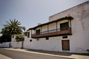 We continue walking east to arrive at Calle Los Príncipes that leads us into the heart of Realejo Bajo, whose town centre was declared to be of Cultural Interest in the category of0 Historic Set in 2005. Artistically, this town centre is the most important of Los Realejos because it conserves nearly 70% of its ensemble. Opposite the park La Parra we pass in front of the Hacienda Los Príncipes that belonged to the Adelantado mayor of the Canary Islands and thus named because through inheritance it belonged to the niece of the fourthAdelantado, Doña Porcia Magdalena Fernández de Lugo, wife of Don Antonio Luís de Leyva, third prince of Aculi and marquis of Atela. This haceinda had the first mechanised sugar mill in Tenerife, as well as mills (still standing and which can be reached goint up Calle Los Molinos), wineries and ponds. In 2009 it was declared of Cultural Interes in the category of Monument and in 2013 the scope was widened to include all the old water management systems that it still preserves.Following the Hacienda Los Principes lies the hermitage of Saint Sebastian, with its architecture that is typical of Canary buildings of this time. It was built by the locals in 1736 and inside is a simple altarpiece wit the image of the name giving saint connected to a pupil of José Luján Pérez.Opposite the hermitage is the Casa de La Parra or Casa de Los Lagares. This building originally belonged to the Hacienda de Los Príncipes, but today forms part of the cultural
infrastructure of the municipality.
We continue walking east to arrive at Calle Los Príncipes that leads us into the heart of Realejo Bajo, whose town centre was declared to be of Cultural Interest in the category of0 Historic Set in 2005. Artistically, this town centre is the most important of Los Realejos because it conserves nearly 70% of its ensemble. Opposite the park La Parra we pass in front of the Hacienda Los Príncipes that belonged to the Adelantado mayor of the Canary Islands and thus named because through inheritance it belonged to the niece of the fourthAdelantado, Doña Porcia Magdalena Fernández de Lugo, wife of Don Antonio Luís de Leyva, third prince of Aculi and marquis of Atela. This haceinda had the first mechanised sugar mill in Tenerife, as well as mills (still standing and which can be reached goint up Calle Los Molinos), wineries and ponds. In 2009 it was declared of Cultural Interes in the category of Monument and in 2013 the scope was widened to include all the old water management systems that it still preserves.Following the Hacienda Los Principes lies the hermitage of Saint Sebastian, with its architecture that is typical of Canary buildings of this time. It was built by the locals in 1736 and inside is a simple altarpiece wit the image of the name giving saint connected to a pupil of José Luján Pérez.Opposite the hermitage is the Casa de La Parra or Casa de Los Lagares. This building originally belonged to the Hacienda de Los Príncipes, but today forms part of the cultural
infrastructure of the municipality.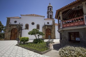 We follow the route along Calle Guillermo Camacho and Pérez Galdós until we arrive, a few metres further on, the church of Our Lady of The Immaculate Conception, the centre of this district from which several streets branch off that are remarkable for their steep slopes. We can contemplate their layout and architectural repertoire with buildings from the 17th through 20th centuries, mostly two stories high.Next to the church is the oldest staircase of the island (1570) which leads to the square of Domínguez Afonso where the Twin Dragon-trees of Realejo Bajo stand.An important point of reference in the area is the Hotel Rural Bentor, which is a perfect
example of how rural tourism has allowed for the rehabilitation of mansions of historic interest.Also remarkable among the most well known and significant buildings is the parish house that dates back to the 17th century, with additions built in the 18th and 19th centuries. It was
built in what is now the Calle El Cantillo de Abajo and has a beautiful balcony on its façade and a sturdy gallery that stands on teak pillars.
We follow the route along Calle Guillermo Camacho and Pérez Galdós until we arrive, a few metres further on, the church of Our Lady of The Immaculate Conception, the centre of this district from which several streets branch off that are remarkable for their steep slopes. We can contemplate their layout and architectural repertoire with buildings from the 17th through 20th centuries, mostly two stories high.Next to the church is the oldest staircase of the island (1570) which leads to the square of Domínguez Afonso where the Twin Dragon-trees of Realejo Bajo stand.An important point of reference in the area is the Hotel Rural Bentor, which is a perfect
example of how rural tourism has allowed for the rehabilitation of mansions of historic interest.Also remarkable among the most well known and significant buildings is the parish house that dates back to the 17th century, with additions built in the 18th and 19th centuries. It was
built in what is now the Calle El Cantillo de Abajo and has a beautiful balcony on its façade and a sturdy gallery that stands on teak pillars.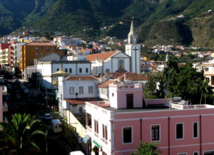 Arriving at the intersection between Calle El Cantillo de Abajo and Calle La Alhóndiga, we continue in a straight line along the former, leaving to our right hand side the old headquarters of the Musical Philharmonic Society of Los Realejos (the oldest musical group of the Canary Islands). We can observe several examples of eclectic architecture before reaching the square of the Shrine of Our Lady of Mount Carmel, situated in the centre of the district of San Agustín, where two of the three convents that the municipality had were founded.In 2008 this shrine, its square and the buildings connected to it were declared of Cultural Interest in the category of Monument. With the celebration of the 50th anniversary of the blessing and opening for service of the church of Our Lady of Mount Carmel, that took place on July 25th of 2015, it becomes the second shrine of Tenerife, alongside the Royal Shrine of Christ of La Laguna.Just in front of the square, in the street Calle San Agustín, you can again have a tase of the exquisite traditional pastry of Los Realejos at one of the branches of Pastelería Abuela Mercedes.
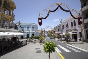 The last part of the route consists of a walk through these streets that invite you to visit the shopping area, or having a delicious meal at any one of the nearby restaurants or tascas.
Image gallery
-
- Monolito de Piedra
-
- Sendero

-
- Vegetación
-
- Camino Real
-
- Vista del Teide

-
- Piedra de Juan Pérez
-
- Líquenes
-
- Salto de Agua
Video of the route
Practical information
Data sheetTransportRecommendations
Details
| Difficulty | Media |
| Duration | 4:30 horas |
| Circular | No |
| Distance | 9,80 km |
| Going up | 4,19 km (43%) |
| Going down | 5,61 km (57%) |
| Max. height | 621,63 mts |
| Min. height | 138,09 mts |
| Slope | 483,54 mts |
| Acc. drop | 1.130,00 mts |
BUS (http://www.titsa.com):
- Barranco de Ruiz (Code 4335): Lines 107, 108, 325 y 363
- Plaza de San Agustín (Code 4190): Lines 330, 339, 353, 354, 380, 391 y 546
- Canarias (Code 4189) (El Puente): Lines 107, 108, 330, 339, 353, 354, 363, 380, 391 y 546
- Servitaxi Realejos: 922 346 045
- Radio Taxi: 922 346 096
PLAN AHEAD: When organising your hike, don’t forget to bring your charged mobile phone, sun protection cream, hat, adequate clothes and shoes, as well as sufficient water and food.
HIKE IN COMPANY: Before setting out, consult the meteorological conditions to make sure they are adequate. Inform family or friends about your route and only walk on marked paths.
AVOID MAKING NOISE: You will enjoy nature better in silence.
DON’T LEAVE RUBBISH: Take any rubbish with you, including anything organic and be
especially careful with cigarette ends. This way you help maintain the beauty of the landscape and prevent the proliferation of rodents.
RESPECT THE ENVIRONMENT: Don’t pick plants and don’t take animals or objects from
their surroundings. Respect the locals’ way of life.
BE CAREFUL: Hiking in nature holds risks. You hike under your own responsibility.
LEGAL DISCLAIMER
This leaflet is meant to be informative. The information it contains can depart from reality and cannot precisely represent the actual state of trails and paths which may have suffered alterations due to weather and other factors after this information was printed.
We remind you that adequate means and equipment have to be used for hiking and that you should always act with the necessary precaution that this activity demands.
The town hall of Los Realejos publishes this leaflet to make the trails of the municipality known to the public and does in no manner assume responsibility for its incorrect or negligent usage.